With native title matters being inherently spatial, the National Native Title Tribunal’s Geospatial Services unit delivers a range of mapping, spatial data and technical expertise.
By Paul Rowe, Director of Geospatial Services at the National Native Title Tribunal.
Native title is the recognition under Australian law that Aboriginal and Torres Strait Islander peoples hold rights and interests in land and waters according to their traditional laws and customs.
Native title recognises pre-existing rights that have survived since sovereignty and continue to exist where they have not been extinguished by valid government acts or interests inconsistent with the existence of native title.
The National Native Title Tribunal (NNTT) is an independent statutory body established under the Native Title Act 1993 (Cth). The Tribunal performs a range of functions under the Act and maintains national registers and schedules relating to native title determinations, applications, and Indigenous Land Use Agreements.
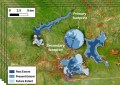
Native title is inherently spatial, with matters all relating to specific areas of land and water. Spatial data and mapping play an important role in helping parties, organisations, governments and the broader community understand the location and extent of native title in relation to other geographic features and interests, including land tenure (pastoral leases, reserves and national parks), mining tenements, and local government boundaries.
Native title is inherently spatial, with matters all relating to specific areas of land and water.
The Tribunal’s Geospatial Services unit supports the NNTT’s functions through the delivery of mapping, spatial data and technical expertise.
Key products and services include:
- Management, maintenance and distribution of authoritative spatial datasets;
- Mapping support to assist people prepare applications and agreements;
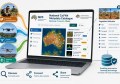
- Native Title Vision, the Tribunal’s online mapping platform;
- Geospatial assessments of native title matters to ensure accuracy and compliance; and
- Spatial analysis to assess the geographic relationship between native title matters and other interests.
The Tribunal’s geospatial data contributes to the broader First Nations policy landscape; Native title spatial datasets are routinely used by local, state and commonwealth government agencies, the resources sector and other practitioners to better understand the extent and distribution of recognised native title rights and interests across Australia.
Through its website, the Tribunal provides free access to custodial spatial datasets, online map services, and a range of national, state and regional map products.
Users can also access Native Title Vision, which enables the viewing and interrogation of native title information alongside other state based spatial datasets. By bringing these layers together, Native Title Vision helps users understand how different interests overlap and interact in a practical and visual way.
These services assist stakeholders to navigate complex land and sea interests and support informed decision-making. The Tribunal’s geospatial capability also supports broader outcomes for Registered Native Title Bodies Corporate. This includes providing geospatial and technical assistance that helps support agreement-making, land management activities and initiatives consistent with section 60AAA of the Act, which promotes agreement-making and practical outcomes for native title holders.
In addition to supporting the Tribunal’s statutory responsibilities, the Tribunal’s spatial data contributes to broader First Nations policy initiatives and national reporting frameworks, including Closing the Gap. The Tribunal provides spatial information and statistical support for the Closing the Gap Dashboard, helping to provide geographic context for social, economic and land-related indicators affecting First Nations communities.
Readers interested in exploring native title information can search the Tribunal’s registers, access maps and spatial datasets, and use Native Title Vision through the Tribunal’s website.
Related reading:
WA native title claim secured after 30 years
GIS maps for NSW Aboriginal Land Councils