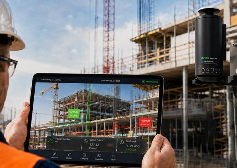
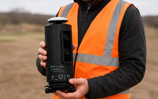
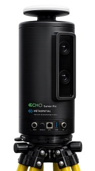
Melbourne-based MetaSpatial Solutions has announced the release of Echo Survey, a patent-pending visual surveying, site verification and monitoring system.
According to the company, Echo Survey is designed to make accurate spatial information easier to understand and use across construction, infrastructure, mining and industrial worksites.
The device combines precision optical measurement, GNSS RTK positioning, visual set-out, AI-assisted analysis and remote site monitoring within a single connected platform.
MetaSpatial, which describes itself as an optical precision and artificial intelligence technology company, says the system is designed to replace fragmented, point-by-point site verification processes with a measurable visual environment.
It says the device enables teams to see where work should be positioned, while comparing actual conditions against designs and monitoring changes over time.
Moving beyond physical markings
Traditional set-out and verification workflows often rely on specialist attendance, isolated coordinate measurements and physical markings placed on the ground or on structures.
Those markings can be difficult for non-survey personnel to interpret and may be moved, damaged, covered or lost as work progresses, and generally represent conditions at only one point in time.
There might be a need for repeated survey visits, producing delays, increasing labour costs and allowing positioning errors, movement or construction changes to remain undetected until they become expensive to correct.
MetaSpatial says its Echo Survey addresses these challenges by presenting precise measurements, design information and site conditions directly within live and recorded imagery.
Instead of relying only on isolated coordinates or temporary markings, engineers, operators and site teams can use visual overlays and measurable targets to understand where work should be positioned and how existing conditions compare with project requirements.
Plans, CAD information and 3D models can be aligned with the real-world site view, providing clear guidance for set-out, verification, inspection and progress monitoring.
This approach helps make complex photogrammetric and spatial measurement information practical for a broader range of site personnel, while retaining the accuracy required for professional workflows.
Fixed or mobile options
The device can be deployed as a mobile visual surveying instrument for set-out and verification or installed as a fixed precision site camera for continuous monitoring.
Through MetaSpatial’s integrated Evolve data platform, authorised users can remotely access live imagery, measurements, design overlays, AI-generated alerts and historical records from a shared interface.
Field teams, engineers, project managers and office-based specialists can therefore review the same information without relying on repeated site visits or disconnected systems.
Those teams can remotely inspect measurable imagery, verify site conditions and monitor changes without unnecessarily approaching active machinery, unstable surfaces, restricted zones, elevated structures or other operational hazards.
AI-assisted detection can be configured for project-specific requirements, including identifying movement, surface changes, unexpected activity, positioning errors, safety concerns or other anomalies.
Echo Survey can also reduce the need for personnel to repeatedly enter hazardous, congested or difficult-to-access areas.
“Echo Survey is designed to turn complex spatial information into clear, practical visual insights,” said Dr. Adam Chabok, Founder of MetaSpatial Solutions.
“By combining precision optical measurement, AI analytics and live visual context, it allows teams to identify changes earlier, collaborate more effectively and make faster, safer and better-informed decisions.”