Marine LiDAR sensor for USV

By on 25 July, 2023

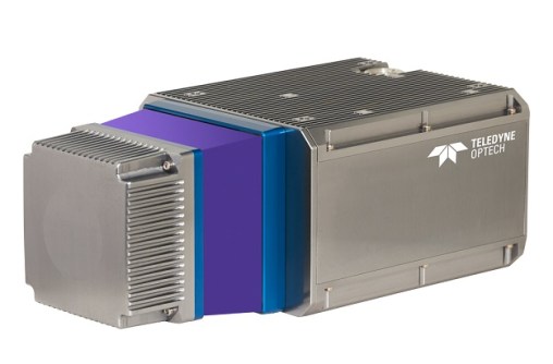
The Teledyne Geospatial CL-360 for marine applications is a LiDAR sensor that can be seamlessly integrated with high-resolution multibeam systems and the CARIS Ping-To-Chart workflow, enabling full above- and below-water image capture with survey grade accuracy in a single workflow.

The sensor’s 360-degree scanner and up to 2 million points/second collection rate provides a suitable solution for mapping coastal infrastructure. The CL-360 is designed for use on an uncrewed surface vessel.

You may also like to read:


, , ,


Newsletter

Sign up now to stay up to date about all the news from Spatial Source. You will get a newsletter every week with the latest news.

QGIS WCPS plugin for multidimensional datacubes
The new QGIS WCPS Plugin enables seamless querying and visua...
Seafloor mapping reveals landslide, tsunami risk
Surveying and mapping are providing insights into some of th...
Company behind Pokémon GO splits off spatial arm
Niantic will spin off its geospatial AI arm into a new compa...
Sphere Drones transitions to in-house production
Sphere boosts its local manufacturing capabilities to meet m...
Terria targets the digital twin universe
We speak with the firm’s co-founders to find about more ab...
Desktop, cloud geographic software
Blue Marble Geographics has launched Geographic Calculator 2...