Each week, Spatial Source finds the best that the internet has to offer.

Google Maps has gone deep with deep learning to update their addresses using StreetView data. A new blog post reveals that Google’s algorithms have become so powerful that over one-third of addresses globally have had their location improved through deep learning technology that recognises text in its natural environment. Find out how it works. [Geoawesomeness]

A new study using Australian Bureau of Statistics data, revealed the areas with the highest and lowest median incomes across Australia. What’s the median income in your area? Enter the name of your suburb or town to find out, or explore incomes in more than 2000 areas across Australia in the map below. What’s number one, you ask? Ashburton in WA. [SBS]

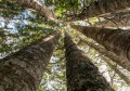
In 1973 three quarters of Borneo was covered in tropical forest. Since 1973 over one third of that forest has been lost due to industrial logging and the spread of industrial oil palm and pulpwood plantations. Find out where Borneo’s tropical forests have been lost and the incredible scale of this continuing deforestation. [Maps Mania]

A new night-time map has revealed the Earth in a whole new light. By comparing satellite data from 2012 and 2016, it reveals where the planet has dimmed and brightened over the past few years. *Cough* India *cough*. [National Geographic]

Finally, a terrifying thought. The new WiGait sensor, developed by MIT researchers is a picture frame sized wall sensor that uses radio signals to detect nearby movement and walking patterns without the use of wearables. George Orwell’s vision of Big Brother just got one step closer. [Spectrum IEEE]