Infrastructure software providers Bentley Systems have announced the release of two new OpenRoads packages, Navigator CONNECT Edition and ConceptStation- two packages that together enable road design workflows from conception right through to set out.

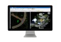
OpenRoads ConceptStation is a conceptual modelling application that enables highway engineering professionals to rapidly produce conceptual roadway designs–based in real-world context–with compelling visualisations. Using contextual information such as point clouds, reality meshes, GIS, and other sources, users can easily create conceptual road and bridge models. It also offers an automated generation of design costs to identify high-cost items or potential risks in the project, extract quantities and analyse project costs.
Once an optimal design is identified, the user can easily upload the model to OpenRoads and OpenBridge to streamline highway and bridge design. OpenRoads ConceptStation models can be brought forward in their entirety for detailed design work into OpenRoads Designer, preserving design data through to construction.
Key capabilities include:
- Georeference contextual information with point clouds, 3D reality meshes, terrain data, images, and GIS data
- Engineering sketching tools
- Automated generation of costs for designs
- Integration of LumenRT cinematic-quality reality modelling software
- Integration of PTV VISSIM to incorporate traffic analysis and planning

OpenRoads Navigator, on the other hand, is designed specifically for civil engineers, surveyors, designers, and other professionals to view, analyse and augment civil design information (including geometry, 3D models and 2D topography) while in the field.
 This allows professionals to make faster, more informed decisions to reduce project risk, while allowing teams to work together to speed approvals and resolve issues during design, construction, and operations.
OpenRoads Navigator supports teams working together to speed approvals and resolve issues during design, construction and operations. In addition, the application integrates with ProjectWise to support collaboration with all team members for faster resolution of issues in the field.
Key capabilities of OpenRoads Navigator CONNECT Edition include:
- View, analyse, and augment a wide variety of project information
- Search and filter models based on attributes
- Locate model elements, station, offsets, and embedded properties
- Walk through projects using satellite navigation
- Create mark-ups including multimedia