The Australian Health Promotion Association (AHPA) last month received the Ray James Award for its research publication “Developing a research and practice tool to measure walkability: A demonstration project.” The tool developed by the researchers has demonstrated the possibility of a ‘national walkability index’ which could help health organisations better promote the benefits of exercise and contribute to better decision making in urban planning.
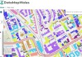
By using open government data, the researchers were able to demonstrate it was possible to create an automated walkability indices for neighbourhoods at user-specified scales. The tool is based on open-source software architecture, within the Australian Urban Research Infrastructure Network (AURIN) framework, and incorporates key sub-component spatial measures of walkability (street connectivity, density and land use mix).
The paper proposes further development of the ‘Walkability Index Tool’ that would help policy makers and practitioners to assess the walkability of local areas; or by researchers to access geospatial data assessing walkability. This could be used for health promotion or in the consideration of walkability in the planning of new infrastructure projects.
The researchers say the next phase of research will look to create a ‘national walkability index’ by increasing useability of the tool within the AURIN portal and exploring options for alternative spatial data sources.
The authors include Nick Middleton, Billie Giles-Corti, Gus Macaulay, Bryan Boruff, Fiona Bull, Iain Butterworth, Hannah Badland, Suzanne Mavoa, Rebecca Roberts and Hayley Christian. The team took out the Ray James Memorial Award, which is presented for excellence and innovation in health promotion. The article was published in CSIRO’s Health Promotion Journal of Australia in 2014 and the team was recognised with their award in October 2015.