

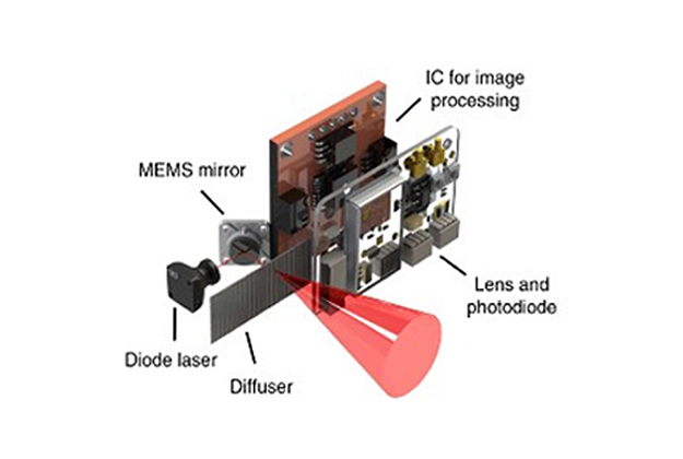
In an effort to reduce the size and power consumption of a typical LiDAR unit, Korean researchers have proposed an ultra-compact LiDAR that uses metamaterials-based ultralight nanophotonics.
Current LiDAR systems, such as those that can be mounted on the roof of a vehicle, are fairly large and somewhat cumbersome.
According to the team from the Pohang University of Science and Technology — led by Professor Junsuk Rho, Dr Inki Kim and PhD candidate Jaehyuck Jang — the nanophotonics method might result in faster and more-precise measurement methods.
The researchers say the technology could be applied to LiDAR systems mounted on autonomous vehicles, robots, drones, 3D panoramic cameras, CCTVs and augmented reality platforms.
“Currently, the research team is conducting several follow-up studies to develop ultralight metasurface-based compound LiDAR systems,” said Professor Junsuk Rho.
“If this research is successful, we can look forward to manufacturing… ultrafast and ultra-precise LiDAR systems at an affordable cost.”
The team has published its research results in the journal Nature Nanotechnology. The work was carried out in cooperation with the French National Science Institute (CNRS-CRHEA).
Stay up to date by getting stories like this delivered to your inbox.
Sign up to receive our free weekly Spatial Source newsletter.


