

Maps Mania
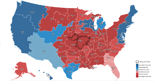
Random States of America is an interactive map which allows you to randomly-generate new state boundaries to create new maps of the United States. Recent presidential election results can then be viewed on your alternate map of America to show you who would have won the election if the United States was configured in a different way.
If you are a Trump supporter still struggling to understand the concept of democracy, you can use Random States of America to change the political map of America. If you keep clicking on the ‘create new states’ button you can keep on redrawing the map of the United States until you finally find a fictional map which the orange one might have won. Just be warned that you might have to click that button a lot.
Once again, we celebrate #PostGIS Day with the newest GeoHipster Calendar
 GeoHipster
Well, we did it again, folks. And by “we”, that’s our community – geohipsters, cartographers, “holiday” voters, and a team of judges came together to produce our best calendar yet for the 2021 edition. Sure, we say that every year…but this year we can also say it’s our biggest calendar, with FOURTEEN maps! The collage above gives you just a taste of what you’ll be getting if you buy one of your own.
 Map of the week
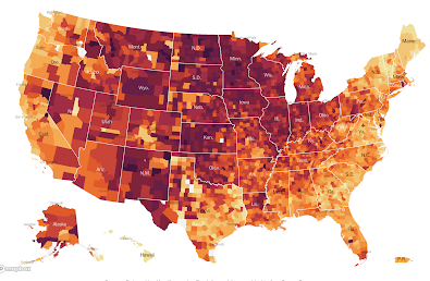
It’s probably too late to sound the warning on Thanksgiving holiday travel but don’t do it! The latest New York Times map shows hot spots all over the country but especially in the Upper Midwest and other rural areas.
 Maps Mania
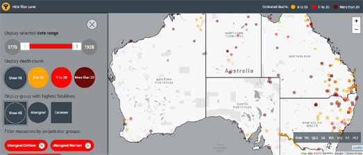
In 2017 the University of Newcastle in Australia released an interactive map of Colonial Frontier Massacres in Central and Eastern Australia 1788-1930. The map is part of the university’s efforts to record and document the massacres of native Australians in Australia between the years 1788-1930. The Guardian has also released a map of frontier massacres in Australia. The Guardian’s The Killing Times covers the same period of Australia’s early colonial history. Indigenous Australian artist Judy Watson has created her own interactive map of Australia’s mass killings. During her multi-media art exhibitions Watson projects the names of hundreds of massacre sites onto a map of Australia. Next to this video projection is displayed a touch-screen map which shows the locations of massacre sites with links to historical documents associated with these massacres.
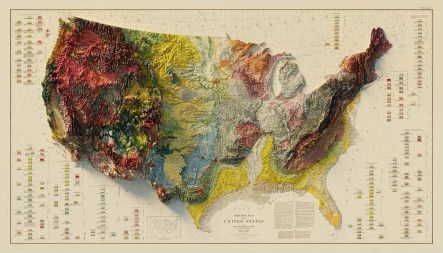
Making 3D Art from Old Geological and Relief Maps
The Map Room
Apparently independently of one another, Sean Conway and Dmitriy Worontzov have been taking old geological and relief maps and applying using digital elevation models to apply 3D effects to them. The end result is a two-dimensional image, or a print, but it’s hard to shake the feeling that these maps now have real depth and texture.
Stay up to date by getting stories like this delivered to your mailbox.
Sign up to receive our free weekly Spatial Source newsletter.


