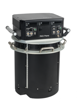
Phase One has introduced the PAS Pana, a seven-camera wide-field system comprising five RGB cameras equipped with 150mm lenses (20.2° along track FOV, 70.0° across track) and two NIR cameras with 70mm lenses (31.9°, 70.0°).
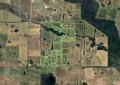
Together, the cameras achieve a total swath of around 48,800 pixels across flight direction, with the range of high-resolution images produced stretching from 2.5 cm Ground Sampling Distance (GSD) to 30 cm GSD.
PAS Pana is fully integrated with the iX Suite workflow software (utilising IIQ, the Phase One’s proprietary raw image format), and the company says the unit has a plug-and play design suitable for any aircraft type.