

SimActive will host a webinar on 24 February, where the special guest will be Dr Mohsen Miri, Director of Global Strategic Partnerships at Phase One.
Dr Miri will share practical strategies for successfully executing large-scale aerial mapping projects and give attendees real-world insight into optimising acquisition and processing workflows.
Topics to be covered will include choosing optimal sensors and settings for large areas, planning efficient missions for wide coverage, managing data volume and quality at scale, and building processing workflows for massive datasets.
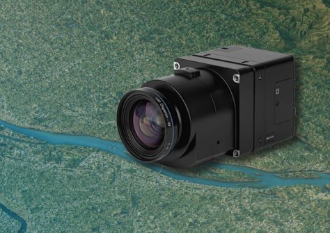
SimActive recently announced full support for the new Phase One iXM-FS130 sensor in its Correlator3D software.
The integration means users will be able to process sub-centimetre aerial imagery efficiently while maintaining speed and accuracy.
The Phase One iXM-FS130 delivers true 1 cm ground sample distance imagery optimised for fixed-wing aerial missions.
Correlator3D, meanwhile, is used to process high-resolution datasets, performing precise aerial triangulation, generating point clouds, dense surface models and orthomosaics suited for engineering and mapping projects.
“The integration of the iXM-FS130 ensures our clients can fully leverage its image quality within a robust and scalable processing environment,” said Louis Simard, CTO at SimActive.
“Together, the technologies deliver unmatched detail and workflow efficiency for high-resolution aerial mapping.”


