The Victorian state opposition is claiming that the recently released bushfire maps omit some key areas, and thus may threaten community safety.
Bendigo East MO Jacinta Allan, the Opposition’s bushfire response spokeswoman, said the maps omit at least 23 sites that the Country Fire Authority (CFA) has listed as “at-risk”.
The omitted towns in central Victoria include Bendigo, California Gully, Castlemaine, Eaglehawk, Junortoun, Kangaroo Flat, Macedon, Maiden Gully and Woodend.
“The purpose of these maps is provide guidance to councils, residents and property owners about the level of caution they should take with their property,” Ms Allan said.
“So they are an important tool to guide people in terms of how they prepare and manage bushfires.
“The concern we have is that these maps send a confusing message to residents, they send a confusing message to local communities because they contradict the advice that comes from the CFA.
“But they also contradict the experience on the ground.
“Whether it be the fires of Black Saturday or the Ash Wednesday fires going back to 1983, they just don’t seem to be consistent with the bushfire experience of those events.”
Ms Allan added that the maps may also confuse residents in streets where one side of the street has to prepare a bushfire plan, while the other doesn’t.
Bushfire Response Minister, Peter Ryan, has defended the maps.
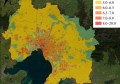
You can view a map of the areas designated as bushfire prone by the Victorian Department of Planning and Community here.