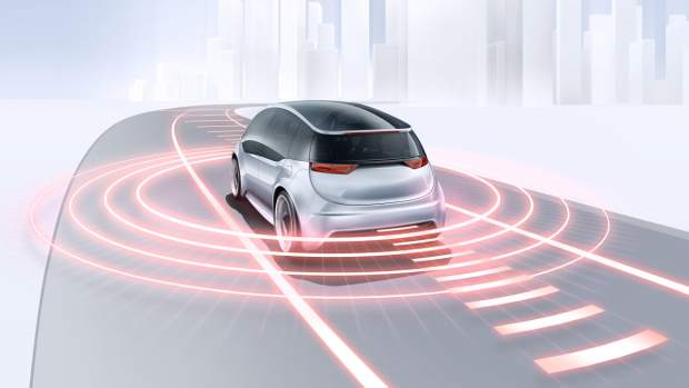
Before safe automated driving can become a reality, a third sensor principle is needed in addition to camera and radar, according to German electronics company Bosch. Consequently, it is making long-range LiDAR sensors production-ready. This laser-based distance measurement technology is indispensable for driving functions at SAE Levels 3 to 5.
The company says the new sensor will cover both long and close ranges – on highways and in the city. By exploiting economies of scale, Bosch wants to reduce the price for the sophisticated technology and render it suitable for the mass market. “By filling the sensor gap, Bosch is making automated driving a viable possibility in the first place,” said Bosch management board member Harald Kroeger.
Technology is alert to all automated driving situations
According to Bosch, only the parallel deployment of three-sensor principles ensures that automated driving will offer maximum safety when it is rolled out. This has been confirmed by its analyses, where developers investigated all use cases of automated driving functions – from highway assistance to fully automated driving in cities. For example, if a motorcycle approaches an automated vehicle at high speed at a junction, LiDAR is needed in addition to camera and radar to ensure the reliable sensing of the two-wheeler. In this instance, radar can struggle to detect the bike’s narrow silhouette and plastic fairings. Moreover, a camera can always be dazzled by harsh light falling on it. As such, there is a need for radar, camera, and LiDAR , with the three technologies complementing each other perfectly and delivering reliable information in every driving situation.
LiDAR is an essential element in automated driving. We can think of laser as a third eye: in LiDAR systems, the sensor emits laser pulses and captures the laser light that is scattered back. The system then calculates distances based on the measured time it takes for the light to bounce back. LiDAR offers very high resolution with a long range and a wide field of vision. As a result, the laser-based distance measurement tool can reliably detect even non-metallic objects at a great distance, such as rocks on the road. This means there is plenty of time to initiate driving manoeuvres such as braking or swerving. At the same time, using LiDAR in vehicles exposes the LiDAR system’s components, such as the detector and the laser, to many stresses – above all, with regard to temperature resistance and reliability over the vehicle’s entire lifetime. Because Bosch can draw on its sensor expertise and systems know-how in the fields of radar and camera technology when developing the LiDAR, the company can ensure that all three sensor technologies dovetail with each other.
Artificial intelligence is making assistance systems even safer
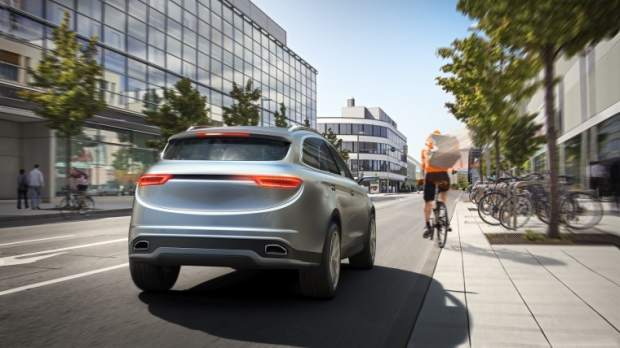
The camera technology detects objects, categorises them into classes such as vehicles, pedestrians, or bicycles, and measures their movement. In congested urban traffic, the camera can also recognise and classify partially obscured or crossing vehicles, pedestrians, and cyclists quickly and reliably. This allows the vehicle to trigger a warning or an emergency braking manoeuvre as required. The latest generation of radar sensors is even better at capturing the vehicle’s surroundings – including in bad weather or poor light conditions. Their greater detection range, wide aperture, and high angular separability are the basis for this improved performance.
Bosch has not provided technical or pricing data at press time.