

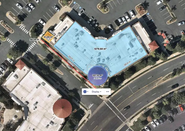
Image courtesy Nearmap
Thoma Bravo has announced that is has completed its acquisition of Australian aerial survey company, Nearmap, in an all-cash scheme of arrangement valued at approximately AUD$1.055 billion.
The acquisition was first announced on August 15, 2022. Nearmap’s shares will be delisted from the ASX on December 16, 2022.
“The partnership with Thoma Bravo underscores the long-term value of our business and represents a unique opportunity to drive further growth across global markets and solidify Nearmap’s industry-leading position,” said Rob Newman, CEO of Nearmap.
“We are confident that transitioning to a private company with Thoma Bravo’s sector expertise, operating capabilities and capital support will position Nearmap to deliver even more value to our customers and partners around the world.
A.J. Rohde, a Senior Partner at Thoma Bravo, said “We are excited to partner with Rob and his talented team to build on Nearmap’s momentum and further expand its global footprint.”
“There is a large unmet need for cloud-based geospatial information technology and comprehensive insights, particularly in North America, representing one of many growth opportunities for Nearmap.”
Nearmap, which was founded in Perth in 2007, has become one of the world’s largest aerial survey companies, providing high-resolution aerial imagery, city-scale 3D content, AI data sets and geospatial tools.


