A 3D model of the NSW town of Young, captured as part of the NSW Smart State Hilltops Reality Model project.
This article was was written by Leanne Mills and Jeffrey Hosken, and originally published in Issue 94 of Position magazine. Leanne Mills is the manager for Environmental Spatial Programs, and Jeffrey Hosken is the GIS specialist for the Department of Finance, Services and Innovation’s Spatial Services unit.
Smart State NSW is a project being run by Spatial Services, which is part of the Department of Finance, Services and Innovation. Smart State has evolved rapidly in the past two years, from a simple software trial, to a project, and now a soon-to-be program of work.
The focus of the project is to transform Spatial Services’ traditional imagery and elevation data products from 2D, to 3D — and eventually 4D. The end result will be the creation of a ‘digital twin’ for the state of New South Wales, which links physical world features with the digital world.
Smart State is opening up avenues for collaboration across industry, education and government partners.
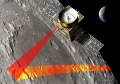
The project team has been working with industry partners and other government agencies to develop products for a broad range of applications including regional development, environmental management and asset management. The work has included trialling different imagery capture sources including aerial photography from fixed wing aircraft, drones and hand-held cameras, 3D modelling software, augmented reality, and indoor modelling of building internals. To meet the needs of the project, Spatial Services is building its drone capability with the purchase of a new fleet of UAVs and the roll-out of staff training for RPAS certification. This has provided a great opportunity for the development of new skills and knowledge sharing with other government agencies.

NSW Spatial Services is developing its drone capability.
Images captured with single frame-based cameras to create 3D models often appear stretched in the final model. Using new techniques to overcome this problem, the Smart State team has incorporated imagery from various sensor platforms and resolutions into one single model to provide additional detail.
The town of Blayney in regional NSW was the location for the initial trial, which progressed to the development of Smart State Hilltops, a project aimed at creating a prototype 3D reality model at the local government level. The Smart State Hilltops project is growing to include agricultural applications and community involvement through a planned series of crowd-led imagery collection activities.
Capturing the imagery for these multi-resolution models is a huge task for one agency. A number of government agencies across NSW also have their own drone capabilities, and Spatial Services is now working with them to utilise, where appropriate, the imagery collected by their drone programs to incorporate them into 3D models.
The project team is also working closely with industry partners to develop an imagery crowd-sourcing app to enable the crowdsourcing of data by everyday people taking photos using their phones or tablets which can then be incorporated into a 3D model.

A 3D model of a building at Level of Display 3.
The future direction of these large footprint 3D models is for not only viewing imagery in a different way, but for the models to be ‘intelligent’ by incorporating attribution from other foundation datasets such as road names or addresses, along with other real-world spatial information. The user will be able to use the dataset to examine property and infrastructure information, or view IoT sensor data in real-time.
Some of the challenges encountered during the project so far include data storage, standardisation of formats for 3D models, delivery mechanisms for 3D models, and coordination across the government and private sectors. The project team is exploring solutions to these challenges through consultation with industry.
A project like Smart State NSW often creates more questions than answers. It is through finding innovative solutions to these issues that improved spatial data products and services become available to support current and future government and business needs.

A 3D model of the town of Blayney at Level of Display 1.