


Industry specialist Bruce Douglas reviews Konect, an innovative mobile field services and mapping solution from Global GBM.
“Konect is a fully-functional mobile GIS, performing in a sophisticated, credible and workmanlike manner, unfettered by network connectivity or being tied to a larger and more expensive GIS suite.”
Bruce Douglas, Director of Corporate GIS has recently undertaken a review of Konect, a mobile GSM product developed by Global GBM. The review was prompted by a full technology refresh of the highly successful GBM Mobile and GBM Portable products, which have been operational for the last 24 years.
 The refresh embraces cloud-based technology with two new major components – Konect Manager (Windows 10 desktop application) and the Konect field app (downloaded from the Apple/Android stores for field staff use).
But what exactly are the key features of Konect and how is it revolutionising field inspections, data collection and workflow synchronisation?
Well, for starters mobile apps on smart phones and tablets offer maximum flexibility at a lower per unit cost. This BYOD (Bring Your Own Device) technology allows users to work online or offline, with full cloud synchronisation, allowing fluid movement between locations regardless of network coverage to ensure a continuous work process.
It’s a game changer, as Ausmec Geoscience Principal and Konect customer, Rod Dawney recently said, “Although Konect wasn’t specifically developed for mining or exploration, I knew that I could adapt it, and when I discovered that it had the offline feature we just bought it. Any functionality I want can be set up. I don’t need phone coverage. I collect the data I want, all customised for my system.”
 Konect, a fully functional mobile GIS, is an installed application – not a lightweight web product – and offers a management framework for multiple data collection personnel to work on different projects while managing base maps and workflow.
Konect is built on points, lines and polygons, which means that all types of data can be collected in the field, not just point locations. This, coupled with a very powerful reference layer feature, means that forms can be pre-populated with data on arrival at site, based on the GPS location which will provide huge on-site time savings.
 Its solid workflow can filter and query multiple data entries utilising a multitude of variants and styles, allowing users of the same dataset to make it relevant to their specific job function or application. This powerful capability is unique to Konect, whereas other mobile apps are generally built for one function only that requires data to be reloaded for subsequent applications.
Rod Dawney summed it up, “I’ve tried other data collection systems and, in my experience only Konect is made to collect data in a high scientific, ordered, flexible fashion, by people who have collected field data themselves.”
Konect is not the only mobile product operating in the GIS / Asset Management space, but it is the leader in combining sophisticated mapping capabilities (derived from its GIS heritage) with good quality workflow management.
 Field inspections, data capture and scheduled tasks for follow-up, synchronised management and control in a mapping-rich, spatial-centric environment all provide users with better information and understanding of work tasks. Whether it’s locating defects, improving time savings and resource deployment, better and more integrated data integrity, or better project control, success comes at minimal cost.
Barry Sullivan, Director of Lagom Agriculture Pty Ltd and more recently co-founder and CTO of AgKonect Pty. Ltd. said, “I’ve seen hundreds of thousands of dollars spent on things that have delivered very little. When it comes to cost-effectiveness, Konect is a very superior product.”
Konect’s ability to work in an Apple or Android app environment, as well as offline, is a refreshing change from other mobile applications, which require a high-cost rollout of Windows devices such as Toughbooks for field staff. It means it can be deployed to maximum numbers of staff on their own smart phones and tablets while still retaining overall project management and control.
 Addressing real world problems with real world solutions has long been key to Konect’s success. Other mobility solutions rely on filling in forms and use the device’s GPS to only get map and address locations for display purposes, but they often lack good spatial connectivity necessary to route staff from job to job and to undertake back-end logistics and workflow management.
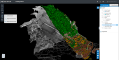
With Konect, you get real-time forms to maps, and maps to forms. This sort of connectivity allows the collected data to be used in a map-rich environment. This allows spatial analysis tasks, such as routing-integrated workflow and point/line/polygon delineation for sites. For example, it could show weed mapping extents, contamination areas and how those relate to property boundaries and locations of interest, all with photographs and other field observations directly connected to each map feature.
A common complaint with some mobility products is that they are either a component of (and therefore require purchase of) a much larger GIS environment, or they require purpose-built applications at some considerable cost and effort to build, deploy and maintain.
Konect on the other hand is very cost effective. Users don’t have to purchase full-suite GIS platforms to get a mobile capability. If the data is required on other common GIS products, it can be easily exported in many compatible formats. It also does not charge for data storage, as do other apps, so collecting large image sets does not result in huge monthly charges.
 Konect is suitable for one or 1,000 field workers, the latter typically being part of an enterprise rollout with teams based on work function.
The Konect workflow function allows users to be assigned based on their job function. Inspectors, auditors, managers, engineers, contractors et al, can all work on the same project at the same time without having to undertake laborious data management processes to ensure that data is not overwritten or scrambled by multiple teams working in close proximity. All of this of course, results in more usable data, better resource management, higher team usage and less downtime. These are all the ingredients of improving efficiency and being more cost-effective.
 In a recent interview, AgKonect CEO, Dr. Pete Whittle said, “New clients say, ‘We have tried pre-packaged products, but they can’t be customised. They do lots of things, but not the things we need.’ By contrast, Konect can be configured to deliver exactly what each of our customers want.”
Konect has successfully packaged the right combination of features in a system that is easily accessible to field crews. As explained by Barry Sullivan “I’ve never had an operator who hasn’t been able to capture good data from day one. Konect’s ease of use, even for older operatives who may not be so tech-savvy is exceptional.”
Konect does exactly what you need it to do.
Corporate GIS is an independent strategic management consultancy in the spatial information industry. Bruce Douglas is also a past president of the Geospatial Information and Technology Association (GITA), ANZ and is a past member of the NSW Board of Surveying and Spatial Information.
![]() For more information visit www.konect.today/location-intelligence/
For more information visit www.konect.today/location-intelligence/


Comments are closed.