

A collaborative project between Centre for eCommerce and Communications (CeCC) and the School of Health Sciences at the University of Ballarat, in partnership with the Australian Sports Commission, Victoria University and VicHealth that involves the development of a spatial ICT system of sporting and recreation data, is gaining much interest from peak sporting organisations in Australia.
The Sport and Recreation Spatial project, which is being lead by Dr Rochelle Eime, joint VicHealth Research Practice Fellow (Physical Activity) at the University of Ballarat and Victoria University, provides a national system for presenting spatial data about the sports industry. The project is also being supported by researchers Dr Jack Harvey and Dr Neroli Sawyer. Through the development of a sport and recreation spatial ICT system – tailored specifically for this project by CeCC – national and state-specific data (including national survey data from the Australian Bureau of Statistics; data from the Exercise Recreation and Sport Survey, ERASS; Victorian sport and recreation facility data; Victorian State Sporting Associations membership data) can be mapped and statistically manipulated to gain a greater understanding of sport and recreational participation across Australia.
The spatial ICT system has wide application and appeal. Not only will it have the potential to offer a greater understanding of the current sport and recreation industry in Australia, but it will provide the industry with evidence to make informed decisions to systematically grow their sport participation in the future. In addition, Sport and Recreation Spatial will provide the capacity to investigate the ‘value of sport’ in terms of participatory health benefits via access to national health and well being measures. It is anticipated that the spatial ICT system will facilitate new research initiatives around the health/wellbeing benefits of sport participation at a community, state and national level. The data system is set for launch in August 2013.
Interest in this project has gained momentum in recent months. In September, Rochelle visited Canberra to showcase the project. A highlight of the trip was a meeting with Cecilia Hemana, Research Manager at the Australian Sports Commission who invited Dr Eime to return to Canberra in January 2013 to present the project to the CASRO Research Group (CRG). CRG is a sub-committee of the Committee of Australian Sport and Recreation Officials (CASRO); one of the key objectives for this group is to improve the range and quality of information about sport and recreation data and research on physical activity trends, and associated impacts and benefits. Importantly, the keen interest and feedback on this project, to date, suggests that the project has significant longer-term research potential.
Further promotion of this project also continues to occur. It was a featured project in the most recent Research Connections newsletter (Victoria-Tasmania edition). In addition, Dr Eime recently presented the Sport and Recreation Spatial project in the Health cluster at the University of Ballarat heats for the Australian Competitive Research Symposium. During the presentation, Rochelle provided a brief yet innovative five-minute overview of the project, using only 3 slides. Rochelle was selected to represent the University of Ballarat in the final of the competition in November where she will compete with finalists from other Australian Universities.
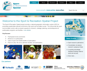
The sport and Recreation Spatial website is accessible at http://www.sportandrecreationspatial.com.au/


