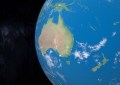
Adelaide Convention Centre – Public Realm
Spatial Source’s guide to the surviving the biggest event on the geospatial calendar, before it takes over Adelaide’s Convention Centre from Monday.
What do you get when you combine Australia’s premier geospatial event with the Asia-Pacific region’s foremost? One colossal program in Australia’s epicentre of high end technology, and a crucial three days on any spatial scientist’s calendar – Geosmart Asia – Locate ’18.
The packed program hosts a massive range of subject matter experts and industry practitioners presenting deep analysis of the most disruptive industry trends: harnessing and leveraging cloud capabilities, artificial intelligence and machine learning, the increasing potential of UAV-derived imagery and point clouds, and the wealth of possibility wrought by the expansion of Australian and international space capabilities.
The show opens on Monday April 11 with the free to attend Market Day , a special edition of GeoRabble and three field trips, to the iconic and sumptuous Penfolds winery, South Australian Health Medical Research Institute (SAHMRI) and Tonsley innovation hub. The DigitalGlobe user conference will take place on Monday afternoon too, from 1pm.

The South Australian Health Medical Research Institute (SAHMRI).
The bulk of the program’s content begins on Tuesday, kicking off with keynotes from Fleet Space’s Flavia Tata-Nardini, Google’s Ed Parsons and Cy Smith, Chief Geography Officer for Oregon. The full program schedule is too extensive to cover, but there are some new tracks that warrant closer attention.
The GeoIntel track will mine the cutting-edge application of spatial techniques in the defence and intelligence communities, and the trickle down of these analytical capabilities, technologies and scales into the mainstream. Gavin Hamilton of the Australian Submarine Corporation will present on taking the Collins-class submarines from 2D to 3D, and Guy Thomas of of C-SIGMA LLC will discuss how space collaboration is furthering global maritime awareness.

The CSIRO’s Dr. Yuri Shendryk.
The sophistication of the topics to be explored in the Agribusiness track should give an indication of the breathtaking pace of development in the sector, for those that haven’t been paying attention. The CSIRO’s Dr. Yuri Shendryk will show how the nation’s peak scientific research body has developed a technique to estimate growth and yield of sugarcane through the effects of nitrogen fertilisation with multispectral imaging and UAV-borne LiDAR. Dr. Stephan Peters of the University of South Australia will examine LiDAR’s applications in measuring timber yield changes in forestry.
Anticipating the imminent proliferation of new spatial capabilities for public health and community management, the Health and Community track will be spearheaded by Dr. Neil Coffee on Wednesday morning, and feature a presentation by Dr. Saad Alsharah of the Dasman Diabetes Institute, Kuwait, on the exciting work they are conducting with the University of Canberra’s Center for Research and Action in Public Health. Penny Baldock of South Australia’s Department for Communities and Social Inclusion will show how spatial data can be used to track the effectiveness of social interventions closer to home.

Anne Harper of Koordinates.
Amongst the deep, detailed tracks on Surveying, Government and Policy and Artificial Intelligence are hidden gems that speak to present and future possibilities, including contextualisation with our friends across the pond. Anne Harper of Koordinates will deliver a detailed breakdown on the state of government data publishing in Australasia, Rohan Bennet of Swinburn Business School will compare and contrast the state of 3D cadastres in New Zealand and Australia, and Fugro’s Hugh Parker will present on hydrography and coastal zone management in the Asia-Pacific by way of airborne LiDAR bathymetry, imagery and multibeam echo sounder.
The Interaction Zone is a new element this year, where delegates can network and get involved in discussions on cross-cutting issues — much of the program in the Interaction Zone is built around inclusion and diversity, with Shelley Fitzgerald and Mary-Ellen Feeney leading sessions on women in the spatial sciences on Tuesday, April 10.
ICSM chair Michael Giudici will lead a day focused around GDA2020’s implementation on Tuesday afternoon, and you can submit a question to the panel discussion here.
Finally, rounding out Spatial Source’s recommendations, don’t miss the update on the 2026 Geospatial Agenda in the closing plenaries, and the formal closing from Dr. Zaffar Mohamed-Ghouse.
There are scores of other fantastic presentations, sessions and activities, again — make sure you get across the full schedule to plan your time to make the most of the bustling schedule.
See you in Adelaide!