

The convergence of the space and spatial sectors was on full display at the Locate conference in Adelaide.
By Jonathan Nally
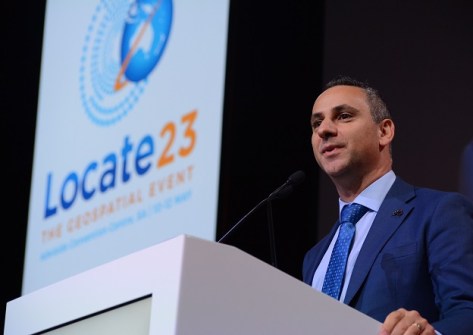
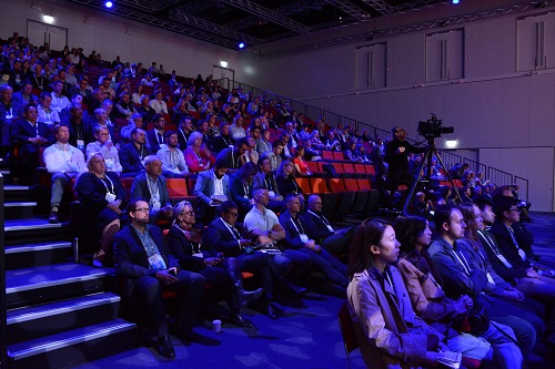
The Locate23 conference was held at the Adelaide Convention Centre in early May, and it was a great success, attracting approximately 750 delegates from across Australia and from around the world.
This was my second opportunity to attend a Locate conference, and I was not disappointed. There was just so much to see and hear; it was impossible to catch it all. But the specially crafted concurrent sessions meant that those who had particular interests were able to focus on their fields of endeavour and catch up on all the latest developments.
The conference was also a great opportunity to network and socialise. There was a definite buzz in the air, and it was plain to see that delegates were enjoying being able to meet and greet one another again.
Space and geospatial workshop
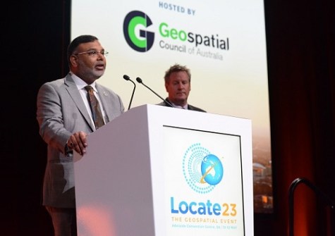
The main event on the Wednesday was the Space & Geospatial Collaborative Workshop, jointly hosted by the Geospatial Council of Australia (GCA) and the Andy Thomas Space Foundation. Prior to the commencement of the workshop, Tony Wheeler, GCA’s CEO, took the opportunity to launch, in person, the extended version of the Space+Spatial Industry Growth Roadmap 2030. He also paid a touching tribute to Dr Peter Woodgate, who was the prime mover behind the initiation of the Roadmap and a giant of Australia’s geospatial sector. Dr Woodgate sadly passed away earlier this year.
The Workshop kicked off with a keynote presentation from Dr James Johnson, CEO of Geoscience Australia (GA). Dr Johnson covered a lot of ground, from the success of GA programs such as Digital Earth Australia and the Digital Atlas of Australia, to the need to use satellite data to present a single, integrated picture for the user (particularly for disaster response purposes). Dr Johnson said the need for “meaningful geospatial data” has never been greater.
Then followed a panel session moderated by Dr Zaffar Sadiq Mohamed-Ghouse, with panellists Reece Biddiscombe (Australian Space Agency), Professor Allison Kealy (Land Use Victoria), Paul Digney (Jacobs) and Professor Andy Koronios (SmartSat CRC). The wide-ranging discussion touched on the need for everyone in the space and spatial sectors to reach out and understand one another’s needs, the democratisation of data and, perhaps most importantly, the acknowledgement that there is now no differentiation between the space and spatial sectors — they are each a vital part of the whole.
A second panel session brought together representatives from agriculture, emergency management, transport, hydrography, IoT and machine guidance to discuss how space and geospatial technologies are being used in everyday life across the country, by business, government and academia.
The Workshop concluded with an address by Dr Geraldine Baca Triveno (Deloitte), who outlined how she sees space technologies enabling new applications on Earth and beyond.
The remainder of Wednesday was given over to a series of concurrent workshops and a symposium, which covered a vast range of topics: from tackling weeds to building digital twins, from developing the geospatial workforce to using gaming engines for 3D spatial data.
Conference sessions
The conference proper kicked off on the Thursday morning. As always, it was impossible to be everywhere at once during the concurrent sessions, but here is a snapshot of some of the things that caught my attention.
Professor Alan Duffy (Swinburne University of Technology) spoke about geospatial’s invisible interaction with our everyday lives and therefore its importance to the whole nation. Bradley Slape (Surveyor-General of South Australia) announced that an agreement had been struck with Flinders University to provide new degrees in surveying and GIS (including double degrees), helping to solve South Australia’s geospatial tertiary education crisis. Paul Digney spoke of how the GCA will become the trusted voice of the geospatial sector, and announced that Commodore Stewart Dunne, the official Hydrographer of Australia, has joined the GCA Board. And Andy Koronios (SmartSat CRC) announced two new space and spatial scholarships.
Head of the Australian Space Agency, Enrico Palermo, announced that the long-awaited positioning, navigation and timing (PNT) roadmap was close to completion. He also spoke of the ways in which space and geospatial combine, such as in forthcoming missions to the Moon. However, there was no mention of funding implications from the federal government’s budget (which had been announced just two days prior), nor was there any information forthcoming on the National Space Mission for Earth Observation.
As mentioned above, a common theme running through the many presentations and panel sessions, was the convergence of the space and spatial sectors. They are now so vitally intertwined that it is no longer possible to see them as completely separate fields.
Interestingly, Joseph Seppi (Woolpert) posed the question: Is geospatial an industry or a sector? He spoke of how in the US, the term ‘geospatial’ is nowhere listed in that country’s official classification of sectors, industries and industry groupings. The same applies in the UK. In the EU, mapping, surveying and spatial activities are listed under ‘Engineering activities and related technical consultancy’ while ‘Aerial Photography’ falls into the same class as the videotaping of weddings.
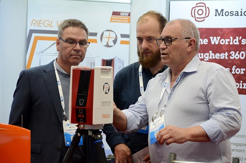
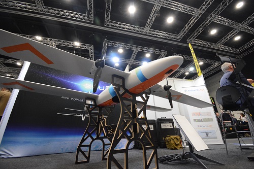
Visiting the exhibition hall, it was great to see plenty of exhibits and displays from a wide range of companies, many of them at Locate for the first time. Products and services on show ranged from drones to software, from 3D laser scanners to consultancy services and everything in between.
It was fabulous to see an effort being made to engage with school students — such as the work being done by She Maps — in the hope of inspiring some of them into geospatial careers. A number of school groups visited the exhibition and could be seen gazing in wonder at the gadgets and gear on display.
Dinner, awards and 2024
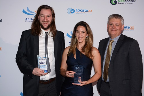
The 2022 Asia-Pacific Spatial Excellence Awards (APSEA) presentation ceremony was held during the gala dinner on the Thursday night. The whole affair was very well run, the food was great and the awards presentations were full of fun, surprise and a good deal of emotion. Many of the recipients (see next page) have dedicated their careers to the geospatial sector and to the use of geospatial data and technologies for making the world a better place. There was a strong sense of gratitude among the recipients for the support and mentoring they had received over the years, with all of them returning the favour by themselves supporting the next generation of professionals and under-represented sectors of the community.
The conference concluded on the Friday afternoon with the announcement that Locate24 will be held at the International Convention Centre at Darling Harbour in Sydney. The convenor will be Narelle Underwood, Surveyor-General of NSW.
There were plenty of other announcements made during the workshops and conferences — too many to list them all here — so keep an eye on spatialsource.com.au as we continue to roll out more detailed coverage of the event. Finally, a big shout out to the organising committee, the GCA and the Locate events team, who put together a fabulous program and ensured the event ran perfectly smoothly. I eagerly await next year’s conference!


