

PARTNER FEATURE
In the ever-evolving landscape of geospatial technology, one company continues to soar above the rest with its commitment to innovation and excellence. Kurloo, a pioneer in position monitoring solutions, is set to revolutionise the industry once again with the launch of its latest innovation, ‘Kurloo Wing’. In June, Kurloo celebrates another remarkable milestone as this product extension becomes available for order, igniting excitement and anticipation among industry enthusiasts.
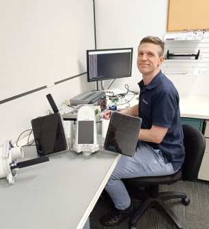
Founded in collaboration with Queensland University of Technology (QUT) in Brisbane, Kurloo has been at the forefront of technological advancement since its inception. Led by founder and CEO Lee Hellen, Kurloo has consistently pushed the boundaries of what is possible, leveraging cutting-edge research and expertise to deliver solutions that meet the evolving needs of the industry.
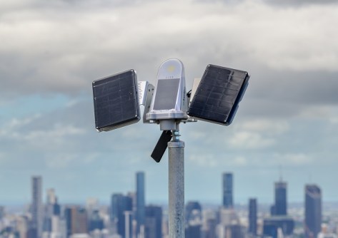
A creation of Kurloo’s team of expert engineers and product managers, the Kurloo Wing represents a significant leap forward in position monitoring capability. Designed to enhance endurance and versatility, the Wing is poised to redefine the standards for precision monitoring in a variety of environments.
Kurloo Wings are modular solar panels that attach to the mounting bracket of the Kurloo device. This extra power enables more frequent position measurement as well as operation in more environments than previously possible. Each Wing features a battery and solar panel and can be used individually, or two Wings can be combined to offer five times the battery capacity and six times the solar capacity of the standalone Kurloo sensor. The Wings can go everywhere the Kurloo sensor can — with the same rugged weatherproofing and temperature-handling capabilities of the sensor, the Wings can expand performance in new and existing monitoring sites.
What sets the Kurloo Wing apart is its seamless integration into the Kurloo monitoring solution. Just like the Kurloo sensor, the Wings have been designed with the installer in mind: this means keeping it simple and reliable. There are no settings to configure, no additional tools required. Assemble the Wing bracket, plug its output cable into the Kurloo, and the installation is complete. Telemetry (i.e. battery health data) will be available in the Kurloo Nest, next to existing telemetry from the Kurloo sensor itself.
Australia is fortunate to have plenty of sunlight, and it is this sunlight that has powered Kurloo devices across the nation to provide the monitoring its users need. With Kurloo now in New Zealand and looking to expand further afield, the company recognised the need for greater capacity to capture energy at lower light levels and to store more of it to maintain operation throughout extended seasons of cloudy weather and shorter days. With one or two Wings installed, Kurloo can also support more power-hungry monitoring scenarios such as multiple measurements per day.
The introduction of the Kurloo Wing marks a significant milestone for the company and the industry as a whole. As the demand for accurate and reliable position monitoring continues to grow, Kurloo remains committed to pushing the boundaries of innovation to meet the needs of its customers.
“At Kurloo, we believe in pushing the limits of what is possible. With the Kurloo Wing, we are proud to continue our tradition of innovation and leadership in the field of geospatial technology,” said Lee Hellen. “We are excited to see the impact that this groundbreaking technology will have on our customers and the industry as a whole both locally and internationally.”
Curious about the Kurloo Wing? Contact Kurloo or book a call to discover how its innovative solutions can revolutionise your position monitoring needs. Visit Kurloo.io today for more information.


