

Clients of projects firm Sinclair Knight Merz (SKM) will soon have access to the latest in mobile 3D laser scanning technology.
A Riegl VMX-250 mobile laser scanning system, purchased earlier this year by SKM through Australian distributor CR Kennedy, is the first of its type in Australia and is now available for use on new projects.
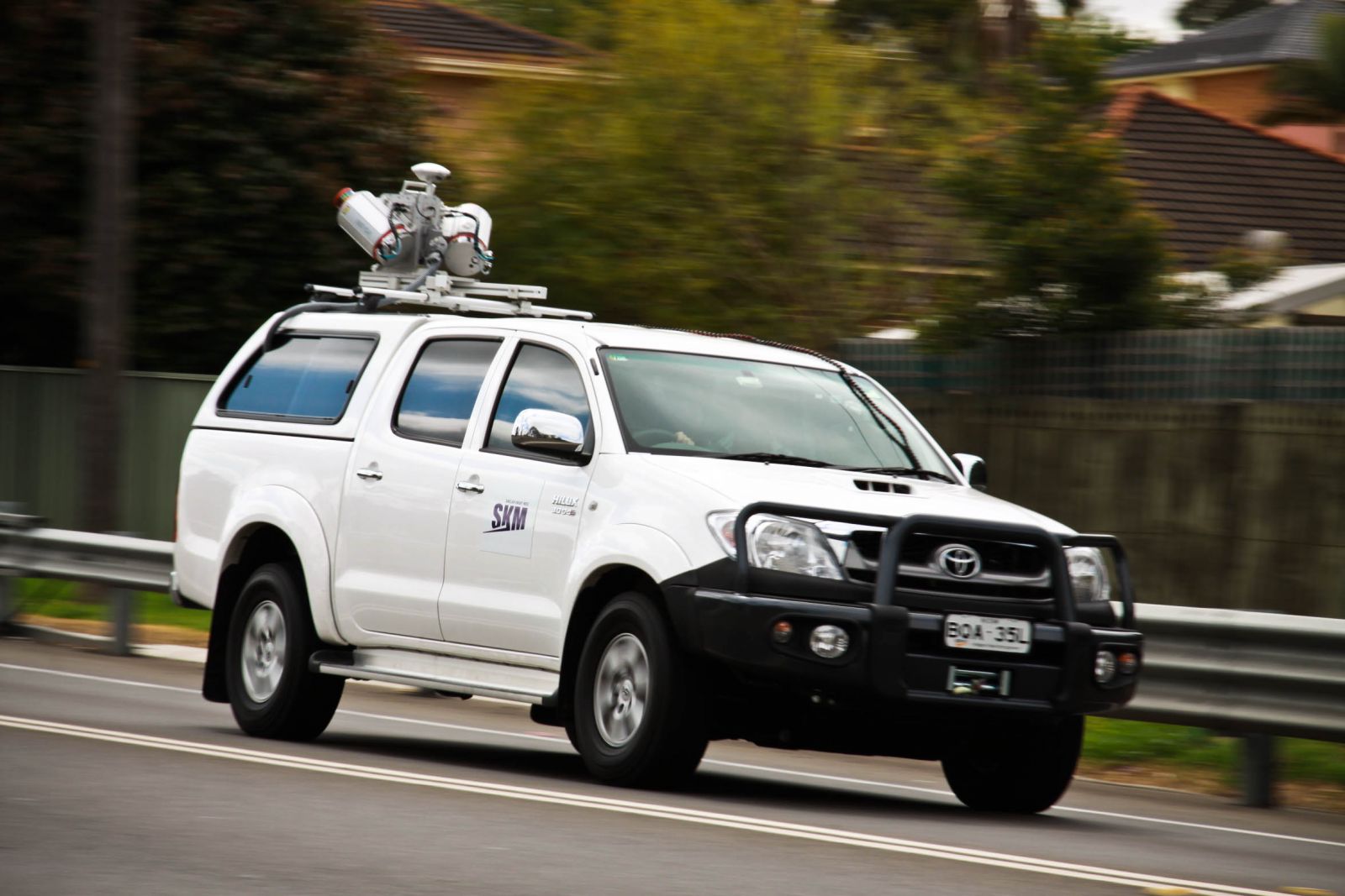
The $1m 3D Scanner, which is mounted on the roof of a vehicle, can be used for a variety of applications such as the mapping of roadways and rail corridors, waterways, ports and harbours, as well as extended urban areas.
Leigh Finlay, survey practice leader with SKM, said the system saves time and money in capturing data as well as improving safety.
“It enables us to capture data from a road just by driving down it, meaning we don’t have to disrupt traffic, or endanger our staff, as was the case with more traditional tripod-mounted techniques,” he said.
“This mobile laser scanner enables our teams to travel a route a few times, gather data and safely return to our offices to convert the point cloud data into a form that can be used by our engineers for our clients.”
Whereas previously it took SKM a day to capture 2-3 km of road data, the new system can collect data at around 40 km per hour.
Each km of 3D point cloud data collected by the device takes up around 1.5 gigabytes of storage space, which increases to 15 gigabytes when it is processed back in the office, ready for entering into design packages.
The car carrying the scanner is equipped with GPS that records the car’s position, and an inertial measurement unit that ensures irregularities in the road do not interfere with the data.
The scanner is accurate to 10-15 millimetres and works best at a range of 40 metres, though it can penetrate as far as 500 metres.
The decision to purchase the 3D Mobile Laser Scanner followed an SKM trial of the technology on a road south of Sydney.
SKM is already in discussions with a number of road authorities and other potential customers about using the scanner in upcoming projects.


