Open Spatial Australia has announced the recent adoption of As Constructed Design Certification (ACDC), by eight Australian councils and water utilities.
ACDC is the first commercial off-the-shelf application that validates ‘as constructed’ drawing information for the contributed/gifted assets from third party construction developers and contractors (developers) against a well-defined standard provided by the client.
ACDC provides the client with a solution to define their standard and distribute this to developers, providing them with clear and accurate requirements of what data to capture when documenting information on the constructed assets. Furthermore, ACDC automates the validation of this information, ensuring that the developers have accurately complied with the client's standard. Once compliance is achieved, the data is directly populated into the client's GIS and Asset Management system.
ACDC is also used to incorporate the client’s own internal capital works as constructed data.
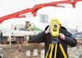
“Prior to developing our current ACDC workflow, the process for capturing as-built data for a new subdivision took about a day and a half,” says Michael Hardman, Geospatial and Business Data Manager, North East Water. “Now, it takes about 10 minutes. The data is more consistent, complete, and accurate.”
ACDC can be used by Local Government Authorities (managing drainage, roads, open space, buildings), utilities (water & sewer, electricity & gas), campuses to collapse the time required to capture the as as-constructed/as-built/work-as-executed drawings containing all of the attributes & spatial information of the new infrastructure required by the client.
The following councils and water utilities have recently chosen As Constructed Design Certification (ACDC):
Councils
- Wollongong City Council (NSW)
- Queanbeyan City Council (NSW)
- Singleton Council (NSW)
- Maitland City Council (NSW)
- Fraser Coast Regional Council (Qld)
Water Authorities
- Goulburn Valley Water (Vic)
- Wannon Water (Vic)
- Wide Bay Water (Qld)
For more information on the ACDC certification visit Open Spatial.