


Thursday’s webinar will canvass advanced hyperspectral imaging technologies and their applications.
Search results for "nasa"
NASA adds new layer to FIRMS and Worldview
The Geostationary Ring Natural Colour RGB global imagery layer is updated every three hours.
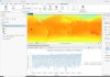
NASA Earthdata releases new GIS tutorials
The four tutorials and data recipes help users brush up on their GIS skills using common GIS software.
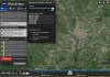
NASA Worldview HLS imagery by area of interest
A new tutorial shows how to find harmonised Landsat and Sentinel-2 imagery by area of interest.

NASA Earth science data now in ArcGIS Living Atlas
The Living Atlas of the World now features NASA data formatted specifically for GIS users.

Geoscience Australia, NASA GSFC to act as IGS ACC
The International GNSS Service Analysis Center Coordinator plays a crucial role in navigation and positioning.

SmartSat appoints former NASA JPL leader as advisor
Larry James will act as strategic advisor to SmartSat and also joins Monash as Professor of Space Innovation.

Esri signs Earth science data agreement with NASA
More NASA-published Earth science data will be made available via Esri’s ArcGIS Living Atlas of the World.

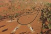
ELA’s first NASA launch is a success
The historic launch from the Northern Territory was NASA’s first from a fully commercial spaceport.
NT invests $5m in ELA as NASA prepares for launch
The NT Government has announced it is co-investing $5 million in space launch start-up, Equatorial Launch Australia.