


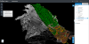
The funding will help commercialise an AI product that extracts features from spatial data for road safety assessment.
Search results for "asset management"
ScanX automates surveyors’ 3D point cloud data
ScanX Cloud eliminates the time consuming task of manual processing and offers unrivalled accuracy and flexibility of the cloud.
Read full story • Comments are closed

The faster road to mobile data capture
Veris reached out to Leica Geosystems to upgrade their existing MLS systems with the new Leica Pegasus:Two Ultimate Mobile Sensor Platform.
Read full story • Comments are closed
Esri Directions Live Online webinar series featuring 1Spatial
When:
18 February, 2021 @ 12:30 pm – 1:00 pm
Where:
Online Webinar
From barrier to enabler: Smarter data management From 3D data to real-time feeds – organisations have access to more information than ever before – but without effective data management systems in place, realising the true[…]

Pix4D, SAP partner on 3D transmission mast inspection
Pix4D and SAP announce new integrated offering aimed at automated asset inspection for telcos.

Mobile Software from Global GBM – Product Review
Industry specialist Bruce Douglas reviews Konect, an innovative mobile field services and mapping solution from Global GBM.
Read full story • Comments are closed
12d Tech Forum 2021 | Online Industry Summit
When:
19 October, 2021 – 21 October, 2021 all-day
Where:
Virtual Event
Hosted by 12d – the companies behind 12d Model and 12d Synergy – the highly anticipated 12d Tech Forum returns on 19 – 21 October 2021. The three-day online industry summit will connect over 2,000[…]

Engineers Australia launches Covid-19 recovery plan
Engineers Australia has called for a greater response to protect health, livelihoods and the infrastructure sector.
SICC Webinar: Reporting and Measuring Bushfire Mitigation Work, a Software Pilot
When:
28 April, 2020 @ 12:30 pm – 1:30 pm
Eugene Lamnek created GeoIT Solutions in 2002, and has been developing ArcGIS customizations, add-ins and applications ever since. In this time Eugene has developed numerous bushfire applications for the CFS and the CFA as well as[…]
Postponed – International Lidar Mapping Forum
When:
23 March, 2020 – 25 March, 2020 all-day
Where:
Walter E. Washington Convention Center, 801 Mt Vernon Pl NW, Washington, DC 20001, United States
Why Attend? International Lidar Mapping Forum (ILMF) is a technical conference and exhibition showcasing the latest airborne, terrestrial, and underwater lidar as well as emerging remote-sensing and data collection tools and technologies. With a special emphasis on[…]