

Image courtesy MethaneSAT
Rocket Lab has been selected to develop a Mission Operations Control Centre (MOCC) for the MethaneSAT mission, which will locate and measure methane emissions from industry and agriculture.
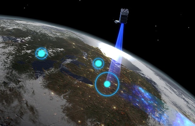
Led by the non-profit Environmental Defense Fund, the 350kg-class satellite will detect methane concentrations as low as two parts per billion and report the results free of charge in near real-time.
Rocket Lab will develop, manage and operate the MOCC in Auckland, as part of the New Zealand Government’s NZ$26 million input into the international program. Responsibilities will include tracking, pointing and positioning the satellite, as well as collision avoidance measures.
“This is an internationally significant mission that can help alleviate modern society’s impact on Earth in a big way, and we’re thrilled to be able to play our part in helping to mitigate climate change through MethaneSAT,” said Rocket Lab CEO and founder, Peter Beck.
Rocket Lab has so far launched 19 missions, deployed more than 100 satellites and operates its own Photon spacecraft. It has previously developed two other MOCCs in New Zealand and the United States.
The MethaneSAT MOCC will be up and running by mid-2022, with orbital operations expected to commence in the final quarter of that year.
Stay up to date by getting stories like this delivered to your inbox.
Sign up to receive our free weekly Spatial Source newsletter.


