

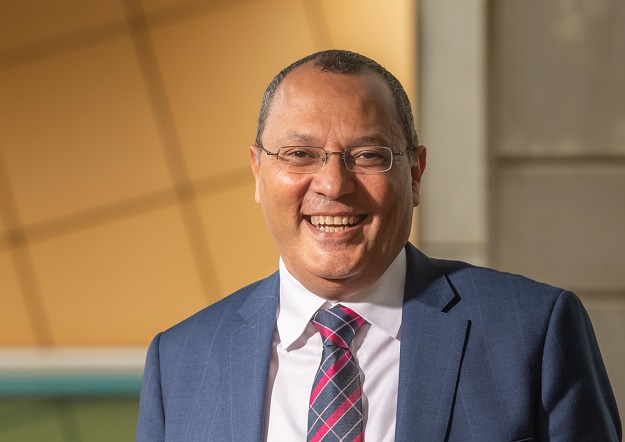
Professor Sherif Mohamed, Dean of the School of Surveying & Built Environment at the University of Southern Queensland.
A passion for applied research has led to an exploration of the potential of GIS in construction applications.
Professor Sherif Mohamed is Dean of the School of Surveying & Built Environment at the University of Southern Queensland. His professional background is in civil engineering, specialising in construction, having earned his Master’s and Doctoral degrees in construction from the University of Southampton in the UK. Following graduation, he worked in the UK for a few years prior to moving to Australia in the mid-1990s.
What sort of research is the School undertaking?
We are involved in a wide range of collaborative research wherever spatial data is concerned. This includes environmental monitoring, hydrology, mining and agriculture. Recently, we had an award-winning project, in collaboration with industry, where farmers can use drone technology for crop health monitoring.
We also undertake collaborative research in spatial data analysis and management to facilitate decision-making. In a recent collaborative study, we helped decision-makers to have a better floodplain management plan as a result of modelling the relationship between vegetation response and available water below the soil surface.
Additionally, the School has an active construction research group focusing its efforts on creating practical solutions to challenges associated with trends such as digitalisation and climate change.
The workforce shortage is driving everybody crazy. Do you have any thoughts about what can be done?
Yes, we are facing skill shortages. Naturally, one of the easiest ways to fill a skills shortage is by inflating wages and salaries, but this is not sustainable because you are dealing with symptoms and not the cause of the problem. Another option is to rely on government intervention on immigration… but practically speaking every industry is now lobbying for the same, and I can see limited benefits in pursuing this path.
So, this leaves us with a third option where industry, in partnership with the academia, can open up skills pathways for their current and prospective staff. Surely, this is not a quick fix solution, but is much more reliable and sustainable over the medium and long terms. Sponsoring a scholarship and offering industry placements are two examples of how industry can contribute to our efforts.
Micro-credentials are an alternative learning option for those who don’t have the time to enrol in a longer qualification. At UniSQ, we are in the process of developing micro-credentials courses in GIS, as well as drone mapping and navigation. Such courses will suit individuals who may not be interested in pursuing a full degree but have a natural interest in GIS, drones, and subsequent data visualisation and analysis.
A lot of people who use geospatial data do not see themselves as being part of the geospatial industry. Is this a concern?
With the emergence and common use of smartphones these days, everyone uses spatial data for even the most basic needs. Location-based services are an important element of everyday life, from finding the fastest route to locating the nearest petrol station. As professionals, the use of GIS/spatial analytics by various industries is only expected to go up in a market driven by increasing global demand for geographically correlated information.
Against this background, I do not see fixed boundaries for the constantly evolving geospatial industry. Having blurry boundaries should pave the way for this industry to embrace and accommodate a variety of disciplines and different kinds of expertise that could lead to the creation of new fields.
My personal view is that the attraction for any discipline to become part of this industry will continue to be its flexibility and its capability tapping into emerging applications. The industry, in turn, will need to welcome and endorse any discipline that can help further growing its domain.
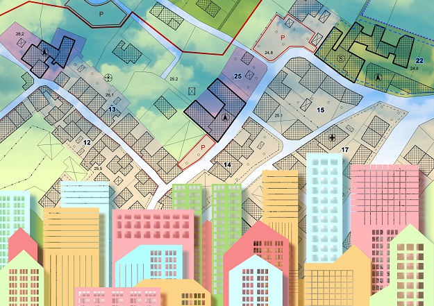
Smart and sustainable cities are the way of the future. As an educator, what kind of professionals are you trying to produce to meet this new future?
I am glad that you asked this question. Given my construction background, I see huge potential for several professional disciplines working together to add value to the various processes of urban planning, design and construction to create a physical environment that adequately supports a healthy, inclusive and productive lifestyle. A ‘smart city’ uses information and communication technology to provide innovative and efficient services, raising the standard of living for all while promoting sustainability and reducing human impact on the environment.
As an educator, I aspire to produce professionals who understand and appreciate that their professional choices have major implications for environmental sustainability and cohesion. They need to be tech- and business-savvy. Their way of thinking should change from linear thinking to multi-dimensional thinking: traditionally, graduates are trained for solving deterministic problems, but the future is all about better decision-making that include uncertainty in problem solving.
The national geospatial education system has shrunk in recent years, but your School seems to be flourishing. What is it doing differently?
Unfortunately, public funding per student, over the years, has fallen in real-dollar-terms, and consequently universities are expected to do more with less. As government funding per student continues to decline, applied programs, in particular, become more costly to run, so no surprise here when universities regularly review and re-evaluate their program offerings.
Fortunately, at UniSQ, our School is bucking this trend. Due to the reputation and flexibility of our program offerings coupled with the professionalism and dedication of our staff, we are now the largest surveying education provider in the country. We offer two-, three- and four-year degrees, i.e. ADSS (Associate Degree Spatial Science), BSST (Bachelor of Spatial Science Technology), and BSPH (Bachelor of Spatial Science (Honours)), respectively.
Our student progress rate has risen from 87% in 2018 to 94% in 2022, well exceeding the government benchmark of 80%. Having said that, we still face the challenges of reduced funding, and for our programs to sustain their leading position there is an urgent need for effective partnership with industry.
What else can be done to promote geospatial careers?
It is worth noting that students under 21 years of age remain the dominant group in higher education. Our School is actively marketing our academic programs via high school visits in our various catchments. We engage with senior high school students, connecting them with experiences that develop their confidence and aspirations for further education. However, we urgently need industry support to further develop our outreach activities to raise high school students’ awareness and level of engagement.
Unfortunately, the surveying/geospatial profession does not effectively and positively sell itself to the broader community, and more specifically to parents and career advisors.
What we need, on top of our existing outreach activities, is to form an academia/industry network that is visionary and entrepreneurial — to be the catalyst for change, thinking outside the box by making the private sector central to our university efforts to inspire young people.
Using the marketing term of ‘call to action,’ I am inviting your readers — the industry representatives — to proactively engage with the School, so that we can develop an inspiring program of promoting the profession to high school students, nationwide.
©stock.adobe.com/au/Francesco Scatena
What fresh ideas are you bringing to your role?
Strategically, the School aspires to be nationally renowned both for the quality of our education programs and for the relevance of our research and scholarship, as well as for the strength of the partnerships that underpin them. With this in mind, I am developing an ambitious engagement agenda with clear objectives to establish close links with industry, professional associations and high schools in order to advance our education and research agendas.
Education-wise, the role of our future graduates will continue to change. The focus of the profession is changing from being very much related to doing measurements to now being increasingly related to management of the measurement processes, the geospatial data, and the property and land-use domains.
Consequently, I’d like to see in our programs a stronger focus on integrating modern surveying technologies into a broader process of problem solving and decision making within the context of surveying applications. Measurement and the ability to integrate data from numerous surveying equipment will continue to be critical but data and information management will continue to gain momentum as we go forward.
What is the School hoping to achieve in 2023?
Our goals include but are not limited to: Grow our student load, enhance our research performance and establish an engagement agenda to facilitate industry partnerships, sponsorship, and student internship. We will be undertaking an unprecedented level of industry engagement to better understand their priorities and we will be using this insight to develop a vibrant education and research unit which meets their expectations.
Our focus is on having positive relationships with our internal stakeholders (i.e. students), and external stakeholders (i.e. employers and research end-users). We must put our stakeholders at the heart of everything we do.


