

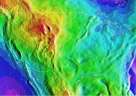
The US National Geodetic Survey (NGS) has shared a prototype geoid model of the US and its territories, known as the GEOID2022, to select key academic and international partners for evaluation.
The model is a foundational component of the modernised National Spatial Reference System — or NSRS, the US coordinate system — which is expected to be released in 2025.
The prototype will increase the accuracy and coverage of precise surface elevation measurements over land and water and will be used to initialise marine circulation models.
The prototype will also communicate water-level forecasts and warnings for tsunamis, surges, flooding and inundation.
GEOID2022 develops a vertical reference of the earth’s surface and includes gravity data from the recently completed 16-year Gravity for the Redefinition of the American Vertical Datum, or GRAV-D project, which collected height data using aerial surveys.
The NGS says that more geoid products and services will be released later in 2024.


