

The Luxembourg Institute of Science and Technology (LIST) has launched three innovative projects under the European Space Agency’s latest Digital Twin of the Earth call.
Focusing on challenges related to agriculture, and urban and coastal resilience, these initiatives will leverage LIST’s cutting-edge technologies in satellite Earth Observation (EO) data processing and environmental modelling.
The ESA call aims to develop EO-based Digital Twin Components (DTCs) to a pre-operational level, creating advanced digital replicas of Earth system components.
One of the initiatives, SaveCrops4EU, which has been selected under the ESA’s Lead Development Actions, will develop a DTC for agriculture, providing tools to help European farmers mitigate the effects of climate change.
By combining EO data with advanced crop growth modelling and machine learning, the researchers aim to provide the in-season monitoring, forecasting and scenario-testing capabilities crucial for effective agricultural decision-making.
“SaveCrops4EU integrates remote sensing, data assimilation and AI for EO to address the challenges faced by European agriculture,” said Mauro Sulis, joint scientific lead of the project with fellow LIST scientist Martin Schlerf.
“By delivering tailored insights into crop health, water and nitrogen status, we are empowering farmers to make more informed decisions, improving sustainability and productivity.”
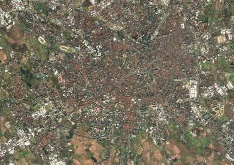
In the realm of urban resilience, LIST is also contributing to a one-year ‘Early Development Action’ project, led by Italian company e-GEOS. This initiative aims to tackle urban heat islands and flooding, combining satellite data, advanced modelling techniques and AI for EO to create turnkey solutions for managing climate-induced risks in urban areas.
LIST will make use of two of its technologies: a patented radar-based technology enabling accurate flood mapping in cities, combined with the high-resolution monitoring of built-up areas, offering near real-time satellite imagery updates of urban infrastructures affected by flooding.
The researchers will thus explore the impact of various climate scenarios on urban infrastructure, using hydrological models to assess and mitigate risks associated with urban flooding and heat waves.
LIST will also work on a project led by Argans (UK) to address the growing risks of coastal erosion, flooding and algal proliferation due to climate change. Researchers will develop advanced flood risk maps for coastal areas based on various scenarios, modelling the interactions between environmental factors, such as riverine floods, storm surges and tides, as well as coastal erosion.
“The combination of advanced satellite data, environmental modelling and AI for EO is key to predicting future risks along our coastlines,” said Patrick Matgen, head of the Remote Sensing & Natural Resources Modelling group at LIST.
“By integrating these technologies, we can provide decision-makers with the tools they need to safeguard these particularly vulnerable regions.”


