

Simulation – Improving Capability and Reducing the Cost of Ownership WHEN: 2010-05-31 to 2010-06-03WHERE: BrisbaneSTATE: QLDCOUNTRY: AUS Simulation Industry Association of Australia http://www.siaa.asn.au/
OCEANS ’10
By Spatial Source on 11 May, 2010Showcasing Advances in Marince Science and Engineering WHEN: 2010-05-24 to 2010-05-27WHERE: SydneySTATE: NSWCOUNTRY: AUS www.oceans10ieeesydney.org/
Introducing the New Epson Stylus Pro 7700/9700
By Spatial Source on 7 May, 2010These new four colour printers with exceptional speed and superior quality output are designed to assist architects, engineers, construction companies, GIS professionals and retailers to expand their businesses. The Epson Stylus® Pro 7700 (24 inch wide) and Epson Stylus® Pro 9700 (44 inch wide) four colour large format printers are designed to deliver enhanced productivity […]
Best of the blogs 31/01/12
By Spatial Source on 1 January, 1970Vector One points us to a history of cadastral mapping in Queensland, as published by the Queensland Government. Well worth a look. http://www.vector1media.com/vectorone/?p=9148 The Telegraph in the UK is reporting that a special summit has been called by the British government to address the issues that outdated maps on consumer’s GPS units are causing. The […]
Best of the Blogs 15 January 2013
By Spatial Source on 1 January, 1970With Summer heating up the Sydney Morning Herald has run a piece on the ‘Nerve centre at heart of Australian fires’ – the GIS systems at the headquarters of the NSW Rural Fire Service. And speaking of fires, the Converstion has a piece that tries to put the recent Tasmanian bushfires into perspective […]
Mapping Earth’s Gravity
By Spatial Source on 1 January, 1970A new model of the Earth’s gravitational field may help climate change researchers and geophysicists better understand our planet. The detailed model is based on the European Space Agency’s GOCE satellite data. The satellite, which was launched in 2009, flies at a low altitude of 254.9 km. The low orbit makes the satellite more […]
NCRIS partners work together to build Soils-to-Satellites tool
By Spatial Source on 1 January, 1970One of the great challenges to increasing the sustainability of land management is the need to integrate many different kinds of data at many different scales. In a step towards addressing this problem, cyber-infrastructure professionals from a number of the Australian Government’s National Collaborative Research Infrastructure Strategy (NCRIS) program capabilities, including TERN, have joined forces […]
Cardno Acquires Australian Underground Services
By Spatial Source on 1 January, 1970International infrastructure services group Cardno has acquired Australian Underground Services. AUS provides utility detection and mapping services using surface geophysical technologies. Its work also includes non-destructive vacuum excavation and data management services. It has around 30 staff based in Victoria. AUS is expected to contribute revenue of around $5 million to Cardno annually. […]
Latest Geospatial News
View allCool Tools
View All-
 Responsible AI for better decisions: Why geospatial context matters
-
 Stop parking it: meeting the Essential Eight with ArcGIS may be more achievable than you think
-
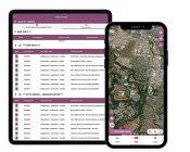 GBM Konect launches Konect 2 to close the field data gap
-
 Inside the 12d Tech Forum 2026: Automation, Collaboration, and the Industry’s Next Chapter
Events
View All-
Oct 30
Western Australia EISSI Awards 2026
 Pan Pacific, Perth
-
Nov 9
2026 Advancing Earth Observation Forum
Hobart, Tasmania -
Nov 13
South West and Great Southern Surveyors Conference
Mantra Bunbury Lighthouse, Bunbury, WA -
Nov 24
Locate26 Conference / 10th Digital Earth Summit
Melbourne Convention & Exhibition Centre -
Nov 30

