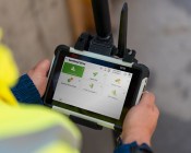
New features automatically highlight terrain features to assist analysis.

$3.8m Pacific project includes spatial learning
Australian academics will work with partners in the Solomon Islands to expand spatial science education.
Read moreLatest Geospatial News
View all
ADVERTISEMENT
Help define the new ASGS standard for 2021.
 2019-06-04
The partnership will initially focus on new rocket propulsion technologies and launch sites.
 2019-06-04
Correlator3D 8.2 features automatic registration of infrared and multispectral imagery.
 2019-06-04
The ASA seeks industry input on proposed regulatory framework for space activities.
 2019-05-29
The ABC and UNSW have announced the winners of the Top Five science media residencies for 2019.
 2019-05-29
ADVERTISEMENT
Markus Schaefer will complete the u-blox executive team.
 2019-05-29
SEASC 2019 organisers release program, announce discounted early bird tickets.
 2019-05-29
 Events
View All-
Nov 24
-
Nov 26
Leica TS20 launch roadshow – Newcastle
 Rydges Newcastle, Merewether Street, Newcastle
 -
Feb 4
PNT 2026 Conference
 Royal Randwick racecourse, Sydney
 -
Feb 17
Geo Week 2026
 Colorado Convention Center, Denver
 -
Mar 4
BYDA Utility Safety Conference 2026
 RACV Club Melbourne


