Earth Sciences New Zealand is undertaking a major upgrade of the New Zealand Landslide Database (NZLD).
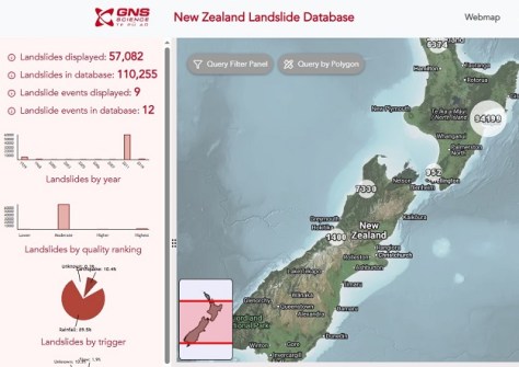
The work will see the number of landslides recorded jump from 23,000 to more than 500,000.
The update will also include more features for each landslide record; for instance, what the triggering event was, the size of the landslide and the damage it caused, all of which will give users more data upon which to base land use decisions.
The NZLD is available online as a webmap that shows previously mapped landslides, especially those set off by substantial rainfall events and earthquakes.
Additional technical information can be obtained by registering for free access, which will make available data such as landslide source areas and debris trails.
According to Earth Sciences New Zealand, the NZLD is used for purposes such as planning new infrastructure developments, protecting assets, undertaking risk analyses and assessments, and for emergency management planning.
Developing landslide hazard and risk models in the face of climate change is one application of particular importance. Such models can indicate areas that might be at higher risk of landslides.
The database updates will be released in phases, with the initial phase comprising more than 100,000 landslides; hundreds of thousands more will be added over the next 12 months.