

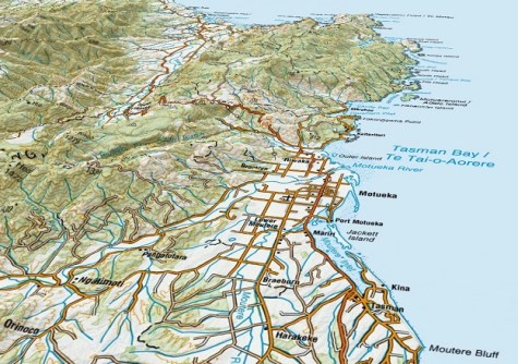
New Zealand’s favourite topographic maps can now be viewed in 3D on Toitū Te Whenua Land Information New Zealand’s (LINZ) Basemaps website.
LINZ recently added the new layer to its free digital Basemaps service, which enables users to explore the country on a web browser from any device.
LINZ Head of Location Information, Aaron Jordan says around 500 Topo50 and Topo250 maps are now available as a single national map on Basemaps.
He says the new ‘NZ Topo Gridless Maps’ layer can be turned on, along with the ‘terrain’ function, to show the landscape, features, and contours, as if someone has draped a printed topo map over a 3D model of the country.
“The new layer brings together all our topo maps in the same service, dynamically switching between them to always show the correct scale, from country wide visualisations, down to the neighbourhood scale,” he said.
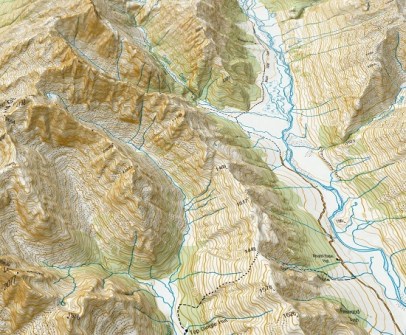
“Our national elevation data underpinning the 3D terrain functionality shines through when exploring at a zoomed-in level, featuring high resolution land details such as farm tracks and river paths.
“When viewing in 3D, it’s a gamechanger for exploring our country digitally using a single resource and brings new understanding of 2D contours in our topographic maps.”
Jordan says that anyone, from schoolchildren through to trampers and emergency services, can use the map to visualise the relationship between terrain and the built environment.
The new topo map layer follows the 3D function LINZ released last year, which elevates any of the available Basemaps layers.
The 3D feature has been made possible by creating a single national 1m digital elevation model LiDAR dataset.
Basemaps can also be accessed via an Application Programming Interface (API) for use in maps, apps, and decision-making tools.


