The NSW state government is tipping an extra $20 million into development of its Land iQ land-use planning tool, to make it more accessible and affordable for a wider range of users.
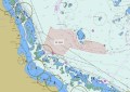
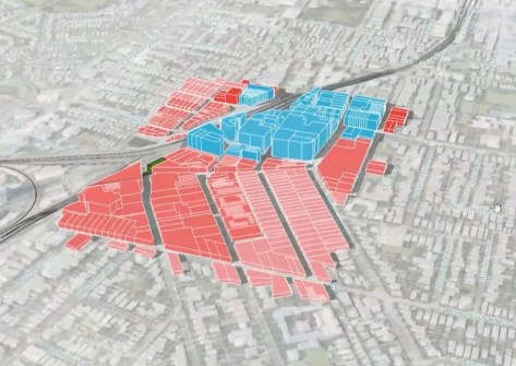
The Land iQ digital platform assists government bodies as well as private consultants and other interested parties to identify land that is appropriate for various desired purposes.
It does this by combining public and private sector data into an interactive 3D map interface, which enables users to:
- Visualise and analyse land;
- Run land-use scenarios;
- Collaborate with property professionals in real time; and
- Optimise land-use plans.
To do this, the platform draws on a library of more than 200 data sources and 75 land-use data types.
Development began in 2021, led by Property and Development NSW along with partners WSP, Giraffe and Aerometrex.
Under continuous improvement, until March this year the platform was not available for licensing to the private sector but now it has been made more widely available.
“We have developed Land iQ to be a functional tool that helps businesses do effective due diligence on various land use scenarios much faster and more effectively,” said James Strutt, Strategic Advisory Services Director with Property and Development NSW.
“It is also very cost-effective for users, with a large regional council indicatively saving $80,000 on a single strategic planning project by using Land iQ versus the traditional approach of procuring professional evaluation services externally.
“A yearly subscription to Land iQ costs just $8,000, allowing users to make ongoing savings when the tool is used across on multiple projects.”

According to the NSW Government, the platform played a vital role in identifying land that would be suitable for emergency housing in the wake of the Northern Rivers floods in 2022.
It’s also being used by the government and local councils to prepare for natural disasters.
The $20 million in additional funding will be used to:
- Expand the use of Land IQ across government to identify land for open space, employment and industrial use, as well as environmentally sensitive land that needs protection;
- Enable users to subscribe to just the parts of Land iQ they need, making it more cost effective for a range of users, such as tertiary educators, councils and land councils;
- Provide access to Land iQ for users of the Giraffe mapping, modelling and analytics software to enhance its capabilities;
- Enable users to access Land iQ data for integrated use with other programs;
- Add more features, such as site feasibility analysis tools that enable integration of individual user data with Land iQ data.
“This significant funding boost expands the program, ensuring the world-first tool isn’t restricted just to government users, but available more widely across all areas of our economy,” said Minister for Lands and Property, Steve Kamper.
In recognition of the work that went into the development of the platform, the then NSW Department of Planning and Environment, WSP and Giraffe were awarded the Innovation Award for Medium to Large Business in the 2024 NSW Geospatial Excellence Awards.
“Our combined strengths in effective stakeholder engagement, holistic land use planning, applied software engineering and data science are enabling our team to deliver an innovative tool to support enhanced strategic decision making,” added Gustaf Jonsson, Digital Interdisciplinary Lead at WSP.
“Our partnership with Giraffe and Aerometrex is essential as we develop the NSW Government’s vision of Land iQ to its full potential.”
In the following video, James Strutt explains how the platform has been used by the NSW Government to streamline planning processes and increase efficiency.