

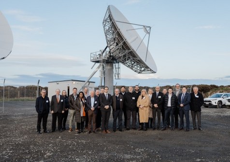
Two new 11-metre-diameter SouthPAN satellite communication dishes have been ‘switched on’ at the SouthPAN uplink and ground control centre at Awarua on New Zealand’s South Island.
The centre is one of two being built for the New Zealand and Australian governments. The first opened at Uralla, NSW, in December 2023.
SouthPAN is a collaboration between Geoscience Australia and Toitū Te Whenua Land Information New Zealand to deliver satellite-based augmentation system (SBAS) services to the Australian and New Zealand landmasses and their maritime regions.
The aim of the project is to improve GPS accuracy from five to 10 metres, down to less than a metre — and in some cases to as little as 10cm.
“New Zealanders use GPS services every single day for everything from ordering food, to navigating the city streets. GPS information is also used for critical technical applications like coordinating an emergency response and air traffic control,” said New Zealand’s Land Information Minister, Chris Penk.
“As the project develops, one of the most noticeable changes for the public will be less disruption to flights during bad weather, with a significant reduction in weather related flight cancellations and delays. SouthPAN services will aid flight navigation, making it safer for planes to land when visibility is poor,” he added.
According to the Minister, an independent report estimated SouthPAN will contribute NZ$864 million to New Zealand’s economy over 20 years, through productivity enhancing and labour-saving applications, such as better resource management, more accurate maritime activities and real-time livestock monitoring through digital fencing tools.
“It is expected this figure could grow as new technologies and innovations are developed to harness SouthPAN’s possibilities,” he said.


