

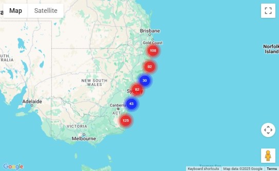
A new online map shows 15,000 hectares of NSW coastal lands that have been acquired and protected over the past 52 years.
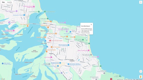
The map enables the user to zoom in and out for detailed or wider views of the NSW coast, as well as providing options for selecting various features.
For instance, coastal features are split into five categories that can be displayed all at once or one at a time:
- Headlands and sea cliffs
- Forest and vegetation
- Beach access and vegetation
- Wetlands
- Parks, campgrounds and recreation areas
The data can also be refined according to local government area, region and site name (e.g. a particular beach, national park, nature reserve and so on).
The Coastal Lands Protection Scheme, which began in 1973, sees land bought by the NSW Government and managed by the local council or the NSW National Parks and Wildlife Service.
The Scheme has purchased and protected 87% of coastal lands originally identified as ‘Red Lands’ on a NSW Government map, and covers the entire NSW coastal zone with the exception of the Greater Sydney area (from Broken Bay on the Central Coast to Minnamurra River south of Shellharbour).
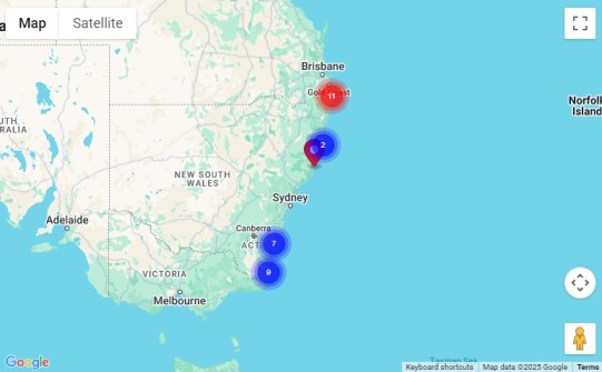
An extra 277 hectares at Nabiac and 78 hectares at Hat Head on the Mid-North Coast will soon be added.
The scheme has also acquired other land that has met the acquisition criteria, while some coastal land has been protected through local land zoning.
Land acquired under the scheme must meet three criteria: it must have public access, have scenic quality, and be of ecological value.
A budget of $3 million is available each year to acquire more land.
“This new map is an informative guide to the vital work of this scheme in safeguarding some of the most picturesque parts of the state for the community,” said Steve Hartley, Executive Director, Environment and Infrastructure Planning and Resilient Places.
“I encourage people to take a look to see how these important parcels are being protected and opened up to the public.”


