

Scientists and river managers are using a new geospatial framework to map and monitor ‘persistent pools’.
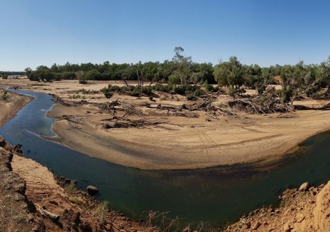
Persistent pools are natural waterholes that act as ‘lifelines’ in rivers that routinely stop flowing.
They are often the last remaining sources of water when rivers recede, providing vital refuges for wildlife and acting as crucial ecosystems for people — from sustaining biodiversity and agriculture to supporting recreation and cultural practices.
The framework has been developed as part of the Resilient Landscapes Hub study from the National Environmental Science Program, published in the Journal of Hydrology.

Lead author of the study, Dr Thiaggo Tayer from The University of Western Australia, says the research is a major step toward understanding the location of the pools and how they change over time under different climate conditions.
“Persistent pools safeguard aquatic and terrestrial life during dry periods, support surrounding communities, and help rivers recover when flows return,” Dr Tayer said.
“Yet despite their importance, we know surprisingly little about how they persist and where they occur.”
The new geospatial framework integrates decades of freely available satellite imagery, rainfall and river flow data to map the presence and persistence of surface water over time.
The overall project, which attracted funding of $590,000, began in February 2025 and will continue until 30 June 2027. It is using data from Landsat, Sentinel and Planetscope.
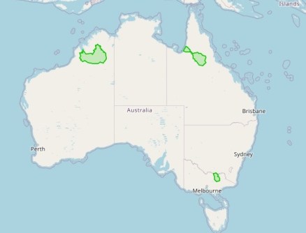
Particular case studies are being conducted along the Martuwarra Fitzroy River (WA), Gilbert River (Qld) and the Ovens River (Vic).
When applied in a case study of the Gilbert River from 1986 to 2023, the method revealed that the river system has trended toward wetter conditions.
The analysis showed that long-term increases in rainfall and discharge have led to a greater number of larger and more persistent pools.
“By harnessing open data and remote sensing, this approach offers an accessible, scalable framework for researchers and managers worldwide,” Dr Tayer said.
“It can help identify critical refuges, detect long-term trends, and guide sustainable water management in the face of a changing climate and increasing hydrological variability.”
Non-perennial rivers, which flow only for some of the year, comprise more than half of the world’s waterways. Yet despite their importance, they have received less scientific attention than perennial rivers.
With rising temperatures, growing water demand and increasing drought risk, understanding how these systems function has become critical.
“As pressure on our river systems grow, protecting these pools isn’t just about conserving biodiversity, it’s about securing the future of the landscapes and people that depend on them,” Dr Tayer said.


