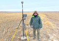
How do photogrammetry production teams manage several projects simultaneously while maintaining efficiency and quality? Pradipta Kumar Mahapatra, Founding Member and Delivery Manager at Impulsions Laser, recently met with our team to present strategies for delivering geospatial data to multiple clients effectively. He also discussed practical approaches for streamlining photogrammetric workflows and ensuring consistent, reliable results.
View this webinar recording on the subject and learn about the following:
- Understanding input data
- Creating a scalable workflow
- Processing large image datasets
- Ensuring high-quality outputs
About SimActive
SimActive is the developer of Correlator3D™ software, a patented end-to-end photogrammetry solution for the generation of high-quality geospatial data from satellite and aerial imagery, including drones. Correlator3D™ performs aerial triangulation (AT) and produces dense digital surface models (DSM), digital terrain models (DTM), point clouds, orthomosaics, 3D models and vectorized 3D features. Powered by GPU technology and multi-core CPUs, Correlator3D™ ensures matchless processing speed to support rapid production of large datasets. SimActive has been selling Correlator3D™ to leading mapping firms and government organizations around the world, offering cutting-edge photogrammetry software backed by exceptional customer support.
For more information, visit www.simactive.com.