There are fewer than seven sleeps to go until Locate24 kicks off in Sydney, so if you haven’t yet registered to attend, now’s the time to do so.
The event will commence on Tuesday, 7 May with a variety of workshops covering topics such as harnessing synthetic aperture radar for hazard monitoring, leveraging digital twins for local government, progress on the ICSM Cadastre 2034 project, hands-on satellite imagery training for NSW government agencies and councils, and many more.
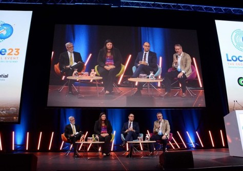
The conference proper will span across Wednesday, 8 May and Thursday, 9 May, and will feature many dozens of presentations from local and international experts speaking on wide array of topics.
Here are just some of the presentations on offer:
- The value of PNT in underwriting Australia’s GDF — Martine Woolf (Geoscience Australia)
- Extending your GIS toolkit for science and research — Dr Sharyn Hickey (UWA) and Jennah Williams (Esri Australia)
- Faster, smarter, stronger disaster response — Ericka Martin (Planet Labs)
- Spatial Vision’s Women in Spatial Program — Amanda Tyrer (Spatial Vision)
- Transforming environmental monitoring with AI — Nathaniel Jeffrey and Dr Yang Chen (Department of Transport and Planning, Victoria)
- Machine Learning to aid in bathymetric LiDAR data processing — Mick Hawkins (Fugro Australia)
- Capturing history: Digital twin of heritage buildings — A/Prof. Zahra Gharineiat (UniSQ)
- Automating building code compliance through integration of geospatial AI and BIM — Nikoo Mirhosseini (University of Melbourne)
The full program can be viewed on the Locate website.
A range of registration options is available, including for GCA members, non-members, young and emerging professionals, students and groups.
Locate is the national geospatial conference of the Geospatial Council of Australia (GCA) and is held annually in a different capital city each year.
- What: Locate24: The geospatial event
- When: 7–9 May 2024
- Where: International Convention Centre, Sydney
- Web: locate.geospatialcouncil.org.au