

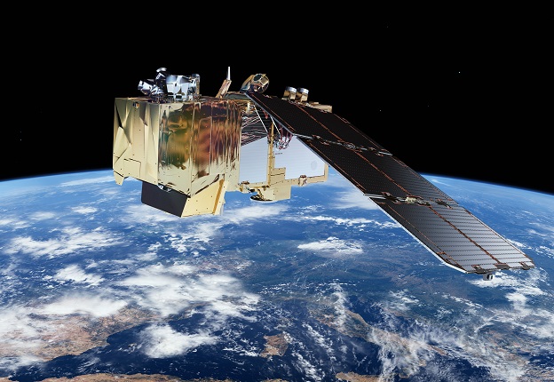
Australian government agencies currently use data from satellites such as Sentinel-2. The new National Space Mission aims to add a homegrown satellite to the mix. Image courtesy ESA.
Australia’s National Space Mission for Earth Observation has been promised $1.16 billion out to 2039.
By Jon Fairall
When then federal treasurer Josh Frydenberg delivered the 2022–23 Budget on 29 March, those pundits who predicted that he would have something for everyone were not wrong — it was designed to delight, and it did. So much cash was splashed around that most media commentators overlooked the $38.5 million per annum earmarked for four satellites, the first phase of a National Space Mission for Earth Observation. The program has been promised $1.16 billion out to 2039 (that’s about $70 million annually).
This is on top of $65.7 million to encourage rocket launches from Australia and $46.8 million to be spent on various other aspects of the space industry (see ‘Space sector strategy’ below).
Industry leaders say it’s not before time. Glen Tindall, the chief executive of space systems at Electro Optic Systems (EOS) in Canberra, says that as the industry matures, the government needs to develop meaningful space missions in the national interest. It’s not enough to fund one-off projects. “You can’t build a sustainable industry like that,” he says.
According to the Budget papers, the National Space Mission will be led by the Australian Space Agency (ASA). The prime contractor has not been chosen yet, although it does seem that many subsystems will be sourced from local companies. CSIRO will develop a specification for the satellite and, once it is on orbit, calibrate it. Geoscience Australia will operate the satellites on orbit, as well as establish and run Earth stations to receive the data and distribute it to users. The Bureau of Meteorology will be a major user of the data. The Department of Defence will deliver foundation geospatial information.
The ASA has yet to reveal who will launch the satellite.
At the time of writing, CSIRO had not detailed the design of the satellite. However, from published sources we know that each satellite will carry a single instrument — a hyperspectral radiometer. This is usually taken to mean a device that images the Earth’s surface at sufficient discrete wavelengths to be able to re-create the entire electromagnetic spectrum over the range of interest.
It is clear the National Space Mission is a response to recent environmental calamities, especially the 2019–20 Black Summer Bushfires. Two enquiries into those fires — the Royal Commission into National Natural Disaster Arrangements and the New South Wales Bushfire Inquiry — highlighted the need for a continent-wide map of vegetative fuel states. Extreme flooding has also challenged the existing infrastructure for mapping and predicting the behaviour of large amounts of water.
This probably means the sensor will have a bandwidth from the thermal infrared down to the visual at 400 nanometres. Such a sensor could provide a map of hot spots to address fire risks — a key design driver — plus something akin to the Normalised Difference Vegetation Index (NDVI) generated by NOAA, Landsat and Sentinel satellites. The NDVI measures the difference between near infrared radiation and red light to provide a measure of vegetation density and condition. Such information is already routinely used by farmers and landscape managers. With better temporal and spatial resolution, it would also be of use to firefighters anxious to monitor fuel load ahead of the firefighting season.

Data from the National Space Mission satellite might be used for disaster monitoring and response. Image courtesy ESA.
In a statement to the media, James Johnson, the chief executive of Geoscience Australia said that potential areas of interest include environmental and hazard monitoring, urban planning, water quality and availability, construction, financial services, resources, and weather analysis and forecasting. “With the constellation in place, it will be feasible to provide updated and detailed crop health information to farmers and agricultural forecasters every day or two. Currently, similar data is only available at eight- to ten-day intervals,” Johnson said.
Another significant design driver is the need to monitor surface water. The most reliable way of doing so would be with a microwave sensor. However, optical frequencies have been used in the past and presumably will be a feature of the Australian satellites. It is possible to monitor many characteristics of water bodies such as turbidity and algal blooms using indices based on visual and near infrared wavelengths. Provided the device has sufficient spatial resolution, its data would also be of great interest to emergency services for flood monitoring
The EO roadmap
The Budget announcement puts flesh on the Earth Observation from Space roadmap, which was released last November by the ASA. At a briefing for media held after the Budget, Reece Biddiscombe, the director of national missions at the ASA, pointed out that Australia had in-depth experience of Earth observation, but all in the role of data consumer. “Australia has always relied on foreign satellites,” he says. ”This is an opportunity for us to go from a consumer to a contributor.”
He said a national EO capability would give the operators of the satellite the ability to capture uniquely Australian data as well as to contribute to the international Earth observation community. It seems this contribution will be a significant design driver for the overall system. In the last few months, the government has signed cooperative deals with the UK and India, and it is currently negotiating with the US.
The US deal is especially interesting. In April the US and Australian governments signed a Statement of Intent at the Colorado Space Symposium. The Statement seeks to ensure the Australian satellites will compliment NASA’s Climate Absolute Radiance and Refractivity Observatory (CLARREO) mission. CLARREO was originally conceived in 2007. At that time, a survey by the US government concluded that the biggest single limitation of the current generation of space-based sensors was that their observations were not accurate enough to see the small changes generated by climate change on a decadal timescale. NASA’s strategy is to improve the calibration and on-going validation of the measurements with a suite of new technologies that enable continual changes to the instruments during the life of the mission.
The first CLARREO satellite was due to launch in 2017. However, it was hit by Trump-era budget cuts and is now scheduled for 2023. Even then, it will be a ‘pathfinder’ mission — an instrument package that will sit on the International Space Station. The first independent missions will fly during the 2030s.
Calibration of the nation
As a result, the National Space Mission has leapt on calibration as the next frontier of remote sensing. CSIRO’s chief executive, Larry Marshall, says CSIRO will lead the development and maintenance of a national network of satellite calibration and validation sites scattered across Australia. This involves defining small homogenous areas whose reflectance can be accurately measured by terrestrial and aerial sensors. These results can then be compared with the results from the satellite. This network will be used to calibrate both Australia’s own satellites and those of foreign operators. Apart from working in support of NASA, some of this work will be undertaken with funding from the UK-Australia Space Bridge Program.
CSIRO will also design, build and manage a new data hub to make the data available to end users, build on CSIRO’s existing strengths in data distribution. The organisation says that the Australian Government currently spends around $100 million per annum on Earth observation from space, a figure that includes the cost of retrieving the data, processing it and then using it in its programs. More than 100 federal and state government programs use data generated by space platforms of one sort or another. On some estimates, these programs cost various governments around $950 million.
As it stands, the source for all this data is foreign satellites. Geoscience Australia runs the Landsat down station, which currently receives daily data from Landsats 7 and 8. GA’s archive provides 40 years of continuous data over the Australian landmass. Landsat multispectral data has been recorded since the launch of Landsat 1 in 1972. Between 1972 and 1979, it was recorded by the US Geological survey. In 1979, a down station at Alice Springs was opened, later joined by one in Hobart.
CSIRO currently runs a repository for the European Copernicus Programme. It provides data from the three operational Sentinel satellites with coverage over Australasia, South-East Asia, the South Pacific, the Indian Ocean and Antarctica. Most of this data is processed in the Open Data Cube (ODC), a processing engine that can take in petabytes of data from multiple sensors and turn it into useable form. Data from the ODC drives Digital Earth Australia, a portal that forms the main interface for users of the system.
CSIRO also has a 10% share of NovaSAR-1, a synthetic aperture radar built by Surry Satellite Technology in the UK.
Looking further ahead
Politicians who need to justify their decision to spend money on creating a space industry, have made a big play out of the industrial activity that will flow from a sovereign capacity to build and launch spacecraft. According to numbers provided by the ASA, about 500 people will be involved in the project — most of them will be employed by about 100 sub-contractors. That will be welcome news for a new generation of Australians who will work in space engineering.
Even so, the politics of all this may yet turn out to be its Achilles heel, says EOS’ Glen Tindall. He says that to build an industry to create, maintain and operate a satellite constellation will require a long-term commitment from government. “It takes decades to bring these missions to fruition,” he says.
So far, there is no word as to what will happen when the first four satellites are built and operational. Will there be a follow-on program? Will we have a sustainable industry in remote sensing? The ASA says the mission will provide a framework for entities across government to consider opportunities for future missions. Yet as with so much in the space industry, it will depend on the whim of the government of the day.
********************
Space sector strategy
The highlight of the Budget was undoubtedly the money for the National Space Mission, but that was by no means the only, or even the largest portion, of government largesse. The funding takes the total amount committed by the federal government to the civil space sector to well over $2 billion since it established the Australian Space Agency in 2018. It’s not quite as impressive as it sounds, since the industry will have a decade or so to spend it. Still, a lot of money is in play.
The government has earmarked $65.7 million over five years from 2021–22 to set the conditions for rocket launches from Australia. The money will be used to fast track the launch of space assets and research projects developed by Australian businesses and researchers.
$2.4 million will be foregone over the next five years by removing cost-recovery requirements under the Space (Launches and Returns) Act 2018. This is part of a wider regulatory reform program to streamline interactions between government and industry.
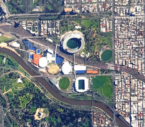
Image courtesy NASA
A $9.5 million Space Strategic Update will be produced to provide direction for the space industry and, most importantly, on future funding opportunities. A further $3.0 million will be spent over the next two years to build relationships with international space agencies. In addition, $25.2 million will spent on Australian businesses and research organisations working on projects with the Indian Space Research Organisation and the broader Indian space sector.
Nor does this include money for Defence to develop space based assets. The 2020 Defence Strategic Update committed $7 billion to ‘transition the Australian Defence force from a consumer to a contributor in space’. Some proportion of that will go to Earth observation. In May 2022, Gilmour Space Technologies announced that it had secured funding to develop a satellite and launch it on an Eris rocket. The contract is part of a $15 million project to develop a sovereign space-based Earth surveillance system for Defence.
********************
Commercial competition
On 6 April, Gilmour Space Technology in Brisbane signed a deal with LatConnect60 in Perth to produce and launch eight Hypersight 60 satellites. Like the satellites produced under the National Space Mission, the Hypersight constellation will carry a hyperspectral imaging system.
Under the agreement, Gilmour will develop a 100kg space platform and launch it on one of its Eris launch vehicles. The announcement was made at the Space Symposium in Colorado Springs in April. Gilmour signed the deal on behalf of a consortium of 31 companies.
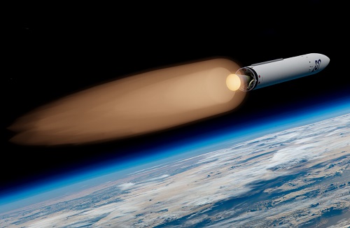
Image courtesy Gilmour Space Technologies
Once all eight satellites are on orbit, LC60 will be able to offer a constellation with hourly revisits over Australia, Asia, South America and Africa.
LC60 was founded in 2019. It currently owns exclusive rights to imagery from the S1-4 satellite owned and operated by Surrey Satellite Technology in the UK. S1-4 was launched on an Indian PSLV in 2018 and is currently in orbit 580 km above the Earth. The on-board scanner delivers 80cm panchromatic and 4m multispectral data.
Jon Fairall was the founder and inaugural editor of Position magazine.
This article was first published in the June/July 2022 issue of Position magazine.
Stay up to date by getting stories like this delivered to your inbox.
Sign up to receive our free weekly Spatial Source newsletter.


