

Mining company Aureka has announced the completion of high-accuracy LiDAR and photogrammetry for the St Arnaud Comstock open-cut pit in central Victoria.
The company simultaneously announced a five-year renewal of the exploration licence for the project, taking it to 2030.
According to Aureka, these are vital steps on the pathway to near-term, low-tonnage gold production.
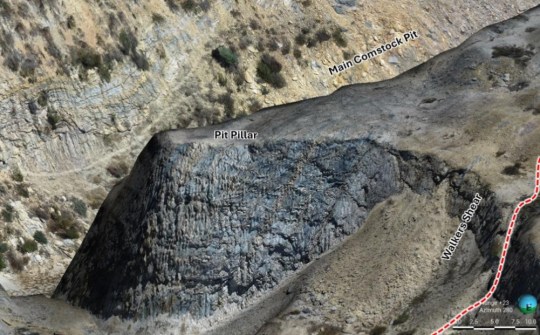
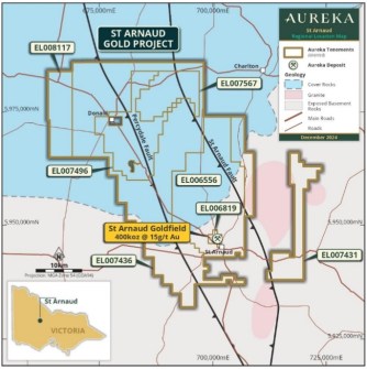
The St Arnaud Comstock pit is a former mine site, which last produced output in1995. It forms part of the broader St Arnaud gold field, which historically produced 400 koz at an estimated 15 grams per tonne.
The LiDAR and photogrammetry capture effort — which was undertaken by Victorian Geology & Survey Solutions — has generated a high-resolution (300 points per square metre) terrain and structural dataset of the open-cut pit.
This dataset will be critical for the engineering design, operational planning and further geological interpretation required to support the strategy of possible gold production.
It will also aid the scoping study that will assess the regulatory pathway and logistics for a possible early start up of the project.
“The tenement renewal and LiDAR, comes after a highly successful 12 months on our promising Comstock Project,” said Aureka’s Managing Director, James Gurry.
“This all sets up Comstock for an exciting future as we progress scoping level studies.”


