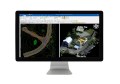
A high resolution Worldview-2 satellite image of Brisbane (Digital Globe Inc.), and a surface cover-type map derived from this and airborne LIDAR data (Queensland Government). Data processed by D Wu and J Knight.
Directors and managers from space agencies around the world met in Brisbane last week for the annual Committee on Earth Observation Satellites (CEOS) plenary, culminating in the launch of the Australian Earth Observation Community Plan.
The CEOS plenary occurs annually and enables short and long term planning of how billions of dollars of funding are directed to designing and operating satellite imaging systems used for remote sensing. As part of the CEOS Plenary, the Australian Earth Observation Community Coordinating Group (AEOCCG) has released the new Earth Observation Community Plan as a roadmap for the next ten years leading up to 2026.
 The 24 page plan was delivered through a presentation at the STEMx conference held in Brisbane on the same week and is now available for download on the AEOCCG website.
In launching the plan, Professor Stuart Phinn, part of AEOCCG and University of Queensland Professor of Geography, said that Australia has a solid foundation of data, knowledge, infrastructure and services on which to build its future Earth Observation capability.
To build this capability the plan aims to deliver a unifying focus to motivate and guide the Australian earth observation community to achieve a 2026 vision. This ultimate goal is to develop and deliver high-quality earth observation information, infrastructure, and services that are used widely by government, industry, research and the community both in Australia and internationally.
The Plan details five priority areas of action for the community to achieve this vision by 2026:
- Connection and Coordination
- Securing Australia’s Role in the International Earth Observation Community
- Infrastructure and People
- Access to Earth Observation Data and Services
- Generating Value
The coordinating group have published the plan and on its website and are now in the process of rallying the troops and encouraging those who use earth observation data to begin implementing its priorities.