After her first year in Australia’s top geoscience job, we find out what’s on Melissa Harris’ agenda for 2026.
By Jonathan Nally
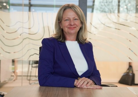
Exactly one year ago today, Melissa Harris became the CEO of Geoscience Australia (GA), the nation’s peak government agency for geoscientific research and services. We felt that this occasion called for a celebratory interview!
Harris began her career almost 35 years ago as a town planner, working her way up in the land management, planning and spatial fields within government. At various points she shifted towards organisational leadership and transformation, becoming Chief Executive and then later the Head of Land Use Victoria and the Registrar of Titles, holding the latter roles for around seven years. “It’s been a fabulous journey,” she says.
So, on the occasion of her first anniversary as head of GA, we spoke with Harris to find out more about her role and what the organisation has in store.
What surprised you about GA when you became CEO?
It’s fascinating, actually, because I thought I knew GA pretty well. But what has struck me since joining the organisation is how incredibly diverse it is and the breadth and depth of our programs. They are pretty extraordinary! I think a lot of stakeholders engage with or identify heavily with particular parts of GA, but rarely experience the whole breadth.
For instance, the fantastic scientific work we’re doing to support the discovery and sustainable development of Australia’s mineral, energy and groundwater resources. The Resourcing Australia’s Prosperity Initiative is a $3.4-billion program we’re delivering with world-leading science and incredible people, capabilities and data, that is helping to accelerate the development of our country’s critical minerals and strategic materials.
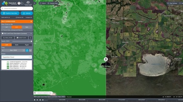
There’s our Earth observation capabilities, including Digital Earth Australia, and the extraordinary partnership that we’ve had over decades with our international partners to curate and distribute Earth observation data and develop the unique, national scale, digital mapping products that are relied on by a large number of stakeholders across the country for important decision making. And the incredible opportunities ahead with the Australian Government’s partnership with the US government to support Landsat Next, which will give us and our community, open access to the next generation of public-good data.
There’s our work on seabed and coastal mapping and administering our maritime boundaries. It’s incredible to think that our maritime zone is 11 million square kilometres in area! It’s important work for a whole range of different reasons that underpin so many critical functions of our country and its economy.
There’s also the community safety work we do supporting emergency response for geological and seismic hazards. We have our 24/7 National Earthquake Alerts Centre, which does extraordinary work. And it is surprisingly busy! There are around 100 earthquakes over magnitude three per year in Australia so this important capability is helping keep Australians safe.
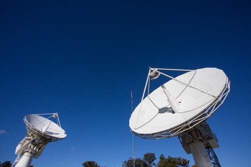
Then there is Positioning Australia, delivering the benefits of accurate, reliable positioning across our land and maritime regions, including delivery of the SouthPAN program. It has been wonderful to learn more about the depth and extent of our positioning capabilities.
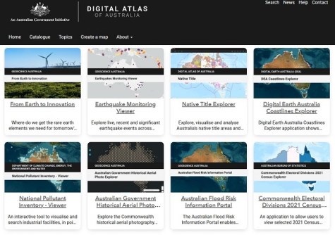
And of course, our many spatial data services and products including the wonderful Digital Atlas of Australia, and our role providing spatial data inputs into some really critical functions including emergency management.
GA sounds like a really busy place!

It is a busy and exciting organisation and there is an incredible amount of value we provide, which so many government programs and industries benefit from. I think one of the statistics that we have is that we support something like 180 government programs.
You mentioned critical minerals. That’s a hot topic at the moment.
Absolutely. Resourcing Australia’s Prosperity has been funded by government for a 35-year commitment to find the critical minerals and strategic materials that are required to support the net zero transition. That investment enables us to obtain and distribute the pre-competitive data that will inform so much of the discovery and responsible development of those essential resources over the coming decades. It’s a pretty inspiring commitment by the government and it is important work we are leading at a critical point in our country’s history.
What are some of the challenges GA faces?
There are definitely skills shortages in some areas; geodesy is one. We also have challenges accessing some of the data and digital skills that we need, as well as in the Earth sciences more generally. A recent report by the Australian Academy of Science looked at all of Australia’s major scientific capability gaps over the next 10 years, and Earth science capabilities are all flagged red and yellow.
So we’re going to have to work creatively over the coming years to make sure that we’re working in close partnership with the university sector, and beyond, to address this issue, including non-traditional pathways for people to enter these professions to try to accelerate the supply of skilled resources.
What about ever-changing technology?
We are a data and technology-heavy organisation, and the custodian of a large number of nationally significant data assets but this comes at a significant cost. I think the sheer scale of our data assets will only increase in coming years, so it’s really about making sure that we have a clear line of sight to what are the critical, foundational, trusted data sets that we have that the world needs, and making sure they are accessible, supported and maintained to an acceptable standard.
The other part is making sure our critical data assets are AI ready and that we’re really harnessing the opportunities of AI to increase the impact of our data and make the production, distribution and maintenance of key data sets as affordable and practical as possible.
What’s coming up in 2026 and beyond?
A lot of our major programs are really shifting gear into delivery mode, particularly SouthPAN for example. We’ve recently finished quite a long phase of critical design and procurement which for something like SouthPAN, as you can imagine, is incredibly complex and detailed.
But that’s all behind us now, so we’re turning our eye to delivery of those critical programs. There’s delivery risk to navigate but over the next few years, we’ll see our country supported by really precise high-tech positioning services, which, I think, will drive huge levels of innovation and productivity.
The first year of Resourcing Australia’s Prosperity was very much in program design and engagement. Last year we really started to kick things off in terms of data acquisitions and insights, and this year I think we will start to see more and more valuable pre-competitive data and scientific insights released, in partnership with the jurisdictions.
And the other big one for 2026 is the Digital Atlas of Australia, which has been the most extraordinary success story. It’s attracted hundreds of thousands of users since its inception. More and more, we’re looking at how we can bring other national-scale data sets into the platform, to drive further uptake and adoption. It’s just fantastic to see the way the Digital Atlas helps democratise data and unlocks additional value from some of the country’s richest data assets, which might otherwise be hard to access.
We will continue to explore the role of AI and our spatial data. We are seeing impressive outcomes. I had a glimpse into the future of how powerful these technologies will be and the importance of our geospatial data being AI-ready.
And probably the other big one on my wish list for 2026 is ramping up our engagement. We’re thinking a lot about how we can get ourselves ‘out there’ more, to ensure all of our stakeholders understand the full breadth of what we do, what we have to offer and the value we provide.
Is there anything else you’d like to add?
I think one of the really important things in the coming months and years, is that the spatial sector continues to work together closely, that we build on that strong legacy of partnership and collaboration we have built up in Australia to make sure that the sector continues to be a strategically important industry that’s well understood and is properly supported, funded and valued by all stakeholders.
I know it has been a challenging 12 months for the sector in some ways, but I want to commend Spatial Source on your new format; I think it’s just fantastic. The more-frequent, digital format is just wonderful in spreading the word about the value of our work and keeping our sector strong and connected.