

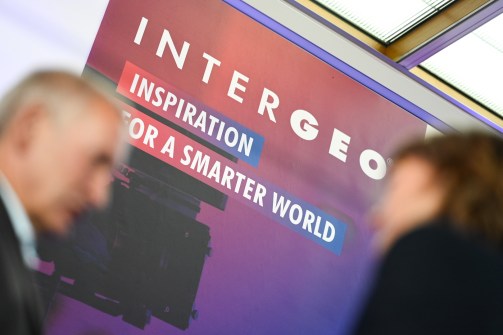
INTERGEO, which takes place every year in Germany, is billed as the world’s largest exhibition for the surveying and spatial sector.
Held this year in Stuttgart, the event attracted 579 exhibitors and more than 17,000 visitors from 121 countries, while the associated conference drew 800 visitors from 47 nations.
There were too many companies, products launches and other announcements to cover them all, but here’s a brief overview of some of the firms that were there, the products they were promoting, and other announcements made.
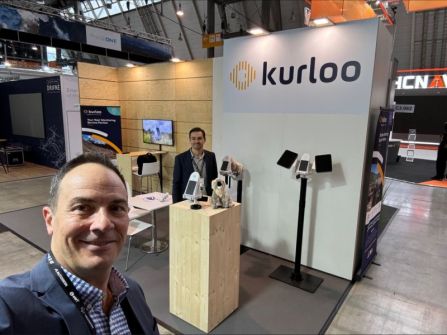
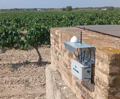
Australian company, Kurloo, was on hand this year to showcase its displacement monitoring technology to the global market and announce an upgraded version. The latest iteration features enhanced wireless connectivity, upgraded accelerometer and tilt sensing, reduced power consumption, a next-gen processor and many other enhancements.
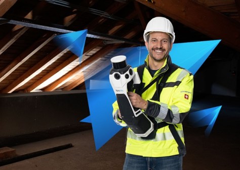
NavVis was there to demonstrate its recently launched NavVis MLX handheld laser scanner, as well as the NavVis VLX 3, NavVis VLX 2 and NavVis IVION products. The company says the MLX delivers high-quality point cloud data captured by a 32-layer LiDAR sensor, and 270- and 360-degree panoramic images.
Leica Geosystems reinforced its partnership with robot manufacturer Boston Dynamics, announcing that the Leica BLK ARC autonomous laser scanning module has become the first certified reality capture device capable of being fitted to the Boston Dynamics’ robotic ‘dog,’ Spot.
Leica also had on display it’s new GS05 GNSS RTK Rover and iCON iCS50 Robotic Construction Tool. The former is described as a lightweight, compact GNSS smart antenna with tilt compensation, while the latter is billed as a construction tool for performing both simple and complex layout and 3D measurement tasks.
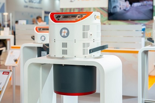
RIEGL showed off its VQ-1560 III-S dual-channel laser scanner, which, it says, is suitable for a wide field of applications in airborne mapping. Also on show was the VZ-4000i-25 long-range 3D terrestrial laser scanner and the VUX-100-25 UAV LiDAR sensor, which has an extra-large field of view for wide-area coverage.
RIEGL also took out the Wichmann INTERGEO Innovations Award in the Hardware category, for its turnkey solution for UAV-based laser scanning based on the RIEGL miniVUX-3UAV and RiLOC-E.
Trimble announced its APX RTX portfolio, which it describes as a “new set of premium direct georeferencing solutions for mapping sensors on UAVs… made possible by the integration of Trimble CenterPoint RTX, which enables real-time and post-mission direct georeferencing of camera, LiDAR and hyperspectral mapping sensors on UAVs with centimetre-level accuracy… without needing base stations”.
Trimble also made a joint announcement with Worldsensing, being the introduction of a solution for long-term 3D ground and structural movement monitoring that combines Trimble 4D Control monitoring software with the new Trimble GNSS Meter. The company says the solution is aimed at the mining, construction and infrastructure industries.
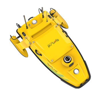
SatLab announced three new product ranges: the Cygnus Lite and Cygnus 2 handheld SLAM scanners and the HydroBoat surveying USV series.
Teledyne Geospatial and Inertial Labs announced EchoONE, a collaboration that combines Teledyne’s LiDAR and camera technology with Inertial Labs’ Remote Sensing Payload Instrument. EchoONE is aimed at the land surveying, electric utility vegetation management and asset modelling markets, as well as transportation and infrastructure projects.
Teledyne Geospatial also showcased a new airborne LiDAR solution, called Galaxy Edge, along with Network Surveyor, which it describes as “a tailor-made solution for utilities” that features Optech LiDAR with Galaxy Onboard edge-processing.
IoT solutions company, Quectel, displayed advanced positioning technologies such as its LG290P quad-band GNSS module, and its RTK Correction Service, designed to deliver RTK and GNSS positioning services to Quectel customers.
SBG Systems was on hand to demonstrate its Qinertia INS/GNSS post-processing software which, it says, provides access to offline RTK corrections from more than 10,000 base stations located in 164 countries.
Gremsy teamed up with Sony and StarCopter to present its latest drone-mounted stabilisation solutions, while SOMAG AG Jena used the exhibition to launch its GSM 5000 gyro stabilisation mount for airborne data acquisition.
These are just some of the many companies and product solutions that were on show this year at INTERGEO. The exhibition will return in 2025, with the venue shifting to Frankfurt.


