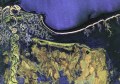
Aerometrex has announced the official launch of its AMX Countrywide aerial imagery initiative, offering dozens of rural towns and communities the benefit of its high-resolution Ultracam orthophoto aerial imagery.
The program commenced in rural Queensland, but has now been extended to South Australian and Western Australian towns, with an on-going capture program also planned for NSW.
Local Government, State Government agencies, Statutory Authorities and utility companies are all beneficiaries of this program, with international sales being made to internet media companies also.
“We see AMX Countrywide as a much faster, cheaper and easier way to provide the same service to the rural communities that we have been providing to major cities for some time,” says Mark Deuter, managing director at Aerometrex.
“It’s obviously a major cost to provide a specific service at a specific time for a small town. The administrative cost in tendering, the mobilisation cost to get to the area and the time delays encountered due to weather can double or triple the actual cost of the survey. It makes much more sense for us to pick up towns if we are in the area flying other projects and to pass these savings on to our country town clients.
In addition there is an overall carbon cost saving by minimising unnecessary mobilisations.“
Country clients are urged to contact George Sioutis at Aerometrex on 08 8361 3111 to check for existing imagery or to have any areas they may be interested to have flown placed on a list of potential projects.
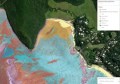
A Google Earth on-line index to the surveys can be found at http://www.aerometrex.com.au/news/countrywide.html
The program is entirely underwritten by Aerometrex, which retains IP ownership of the imagery and provides end-user licence agreements to its clients.
According to Mark Deuter, enthusiastic endorsements have already been received from several SA Councils.