

London Gatwick airport has developed a new geospatial platform to support multiple operational areas, including engineering and environmental services.
The system is making engineering and construction works safer by reducing accidental strikes on buried utilities, while also enabling better management of the airport’s biodiversity.
The geospatial platform, based on Esri GIS technology, contains critical infrastructure information spanning the 70-year history of the airport, including BIM, CAD, utilities, environmental, aerial photography and legacy data.
By integrating all spatial data into a single view, combined with spatial analysis tools, mobile apps and dashboards, the platform provides insights to support better collaboration and decision-making.
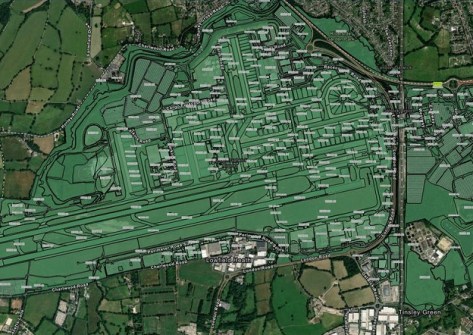
In particular, the single view of buried assets such as gas, electricity, telecoms, water and fuel, is proving crucial in reducing accidental damage across the 647-hectare site.
Field engineers, third party contractors and major consulting firms all use the same single view of data, accessible on any device, when planning excavations. The airport has up to 50 engineering and construction projects on site at any one time.
London Gatwick is also using the platform to support its award-winning Biodiversity Action Plan, designed to deliver a biodiversity net gain at the airport by 2030. Within its boundaries are 75 hectares of woodlands, grasslands and wetlands, inhabited by hundreds of species of mammals, birds and insects.
“Being able to visualise and interrogate all spatial data from any discipline, on any device, is critical to the sustainable future of London Gatwick,” said Simon Richardson, the airport’s Digital Information Lead. “Democratising spatial data in this way drives significantly more business and operational value from it.”
“Requests for new types of online maps are coming from across the business on a daily basis so the system is growing all the time,” added Richardson. “We expect the geospatial platform to grow significantly within the next 12 months.”
London Gatwick is the busiest single-runway airport in the world; more than 40 million passengers passed through in 2023.


