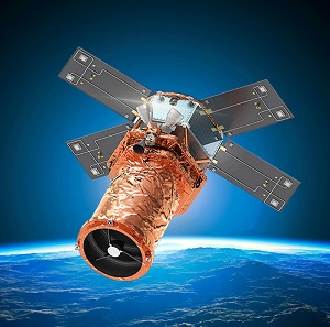
Geoimage has announced global access to the SpaceEye-T Earth observation satellite.
Launched in March 2025, SpaceEye-T, owned by SI Imaging Services (SIIS) and built by Satrec Initiative, offers 25cm native panchromatic and 1m multispectral resolutions.
According to SIIS, it is the highest-resolution, commercial, optical Earth observation satellite currently available.
Geoimage’s partnership with SIIS makes the company the first authorised commercial user of SpaceEye-T imagery and assured tasking services worldwide. Imagery can be tasked and acquired globally, with the exception of reserved areas restricted under existing exclusive Satellite-as-a-Service agreements.
The deal means that Geoimage clients can access flexible global tasking and imagery products, enabling rapid acquisition of ‘very very high-resolution’ satellite data.
The satellite operates in a sun-synchronous low-Earth orbit, making it suitable for applications such as infrastructure monitoring, urban mapping, disaster response, mining and environmental management.
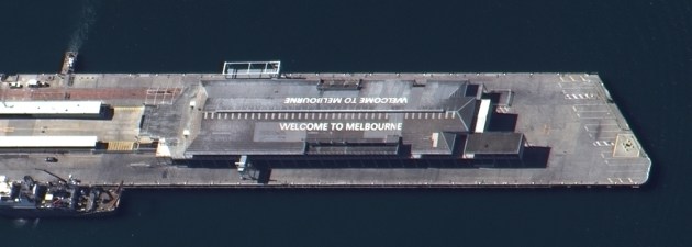
“Since 2014, the benchmark for optical imagery has been 30cm resolution and this has been seen as ‘state-of-the-art’,” said Mark Covington, CEO of Geoimage.
“Our friends at SIIS have moved the goal posts for the industry, with their capability of capturing 25cm resolution imagery. This now represents the highest commercially available optical imagery available, and our unique partnership allows us to task this satellite across so many areas of our planet, not just Asia Pacific.”

“While a difference of 5cm in resolution doesn’t sound like much, the imagery needs to be seen to be believed — 25cm will make a real difference to anyone interested in monitoring assets or changes in landscape at a very, very high level of detail,” Covington added. “Welcome to a new era.”