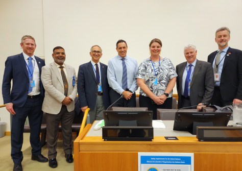
A high-powered delegation of Australian geospatial experts, led by Lisa Bush of Geoscience Australia, attended lasts week’s 13th Session of the UN Committee of Experts on Global Geospatial Information Management (UN-GGIM).
During the meeting it was announced that Nicholas Brown, currently the Director of National Geodesy at Geoscience Australia, will take up a new role as head of the UN Global Geodetic Centre of Excellence (UN-GGCE) in Bonn, Germany.
In 2020, the UN-GGIM accepted an offer from the Federal Republic of Germany to establish and host what would become known as the UN-GGCE at the United Nations Campus in Bonn, Germany.
“The Centre of Excellence is going to provide important contributions to a UN Member State-agreed worldwide geodetic infrastructure,” said the State Secretary at the German Federal Ministry of the Interior and Community, Juliane Seifert, when the agreement for the Centre was signed.
“This infrastructure is the reliable long-term foundation for applications like satellite navigation, space-borne Earth observation as well as monitoring of the UN Sustainable Development Goals 2030.”
Writing on LinkedIn, Brown said that “The Centre will help Member States and geodetic organisations work better together to sustain and improve our geodetic infrastructure, capacity development and the way we communicate the importance of geodesy to policymakers.”
As well as Bush and Brown, the other official Australian delegates at the UN-GGIM meeting were:
- Dr Zaffar Sadiq Mohamed-Ghouse, Director of Advisory & Innovation with Woolpert, Chair of the UN-GGIM Private Sector Network and Board Member of the UN-GGIM Geospatial Societies;
- Prof. Abbas Rajabifard, Discipline Leader of Geomatics, Director of Smart Sustainable Development and Leader of the Future Infrastructure Research Program at the University of Melbourne, Director of the Centre for Spatial Data Infrastructures and Land Administration and Board Member of the UN-GGIM Academic Network;
- Dr Greg Scott, UN-GGIM Inter-Regional Adviser;
- Chris Body, Geospatial Standards Architect at Standards Australia, and Member of the UN-GGIM Land Management Working Group; and
- Ryan Keenan, Principal Consultant at Positioning Insights, Chair of the FIG Commission 5 Positioning & Measurement, Member of the International Advisory Committee for the UN-GGCE, FIG Representative to the UN-GGIM Subcommittee on Geodesy, and Industry Representative to the UN-GGIM ETCB Working Group.
In his opening remarks to the 13th Session, Li Junhua, UN Under Secretary General for Economic and Social Affairs, said that “I have learned a lot in my daily work about the importance of geospatial information for guiding policy decisions at all levels, especially for advancing implementation of the 2023 Agenda and the Paris Agreement”.
“In a world increasingly reliant on higher accuracy measurements and location-based services, collaboration, coordination and coherence in global geospatial information management is more important than ever before,” he added.
“The United Nations is the right place to foster the need cooperation. However, the availability and accessibility of quality, timely and reliable geospatial information remains a challenge, as does the capacity of countries to produce the information they need.”
You can read a summary of the outcomes of the 13th Session’s deliberations here and here.


