

LINZ Basemaps data is being used to help control pest species and improve native habitats across New Zealand.
Groundtruth, a sustainable land management organisation, is using Basemaps through its free website and app, called Trap.NZ, which has revolutionised pest control across the country.
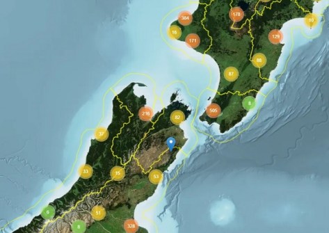
Trap.NZ enables volunteers and community groups to map and monitor their pest control activities, identify trends and target pest hotspots effectively.
Established a decade ago, Trap.NZ is now being used to support over 8,500 pest control projects.
In the past year alone, the tool has helped members control 700,000 pests, including:
- 311,533 rats
- 168,449 possums
- 45,350 hedgehogs
- 34,752 mustelids (i.e. ferrets, stoats and weasels)
Groundtruth’s Chief Technical Officer Daniel Bar-Even says Basemaps was essential to the formation of the website and app, and making the tool free to use was crucial to encourage widespread adoption.
“The fact we can use LINZ quality maps for free has been critical to the success of the project,” he said.
“We’re currently in the process of developing something similar in Australia and we’ve found it to be much more challenging as the data isn’t freely available.
“We didn’t realise how lucky we are here in New Zealand to have a national organisation providing free access to maps across the country. It’s just gold.”
Bar-Even says due to the remote nature of the work, it was also important the app was available offline, as a lot of the areas where people are trapping are out of mobile phone reception range.
“That’s another reason why Basemaps is so valuable. With a lot of other providers to have the information available offline it gets trickier and incurs costs.”
Another benefit of Basemaps is that LINZ uses Open Geospatial Consortium standards, making the data easily compatible with different systems. The 3D addition has also been a useful feature for users.
“When it comes to pest control, mapping is a pretty important part of it, and we’re thrilled Trap.NZ has proved hugely popular with the public.”
Groundtruth has also used Basemaps for a similar initiative to support weed control projects. The app and website, called WeedManager, enables weed locations, density, controls and checks on controls to be entered while in the field (including areas without mobile phone coverage).


