The European Space Agency (ESA), the Finnish government and the Finnish Meteorological Institute have announced plans for establishing a ‘supersite’ for Earth observation calibration and validation in Sodankylä in Finnish Lapland.
Envisaged as a joint investment, the site would be developed through ESA’s FutureEO research and development program.
“Over the next three years we will work closely with the Finnish Meteorological Institute to turn their Arctic Space Centre into an Earth science and calibration and validation supersite” said ESA’s Director of Earth Observation Programmes, Simonetta Cheli.
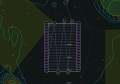
“The centre’s high-latitude position and being surrounded by boreal forest, which is representative of the wider circum-polar forest and tundra ecosystem, make it ideal to validate and calibrate data from our satellites as they orbit above.”
ESA’s Head of ESA’s Earth Observation Campaigns section, Malcolm Davidson, said, “With plans to introduce capacities to calibrate and validate microwave, multispectral and hyperspectral, and greenhouse gas observations, the expansion of the centre to a supersite would enables it to take up a major role for numerous upcoming missions.
Davidson said a variety of missions could benefit from the development, including the Copernicus Anthropogenic Carbon Dioxide Monitoring mission, the Copernicus Imaging Microwave Radiometer mission, the Copernicus Hyperspectral Imaging Mission, the Copernicus Polar Ice and Snow Topography Altimeter mission, the Radar Observing System for Europe at L-band, and the Earth Explorer FLEX mission.