

New Curtin University research could change how space missions are conducted and lead to improvements in industries as diverse as environmental management, agriculture, disaster management and infrastructure inspection.
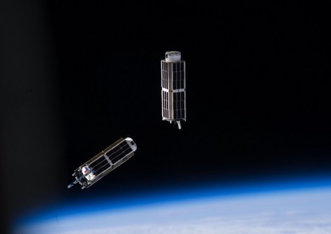
With funding from the Australian Research Council, the GNSS Satellite Positioning and Navigation Group (GNSS-SPAN) team from Curtin’s School of Earth and Planetary Sciences has developed a breakthrough in the operation and monitoring of CubeSats.
The project saw new algorithms developed to use links between satellites to precisely determine a CubeSat’s position, whether flying individually or in formation.
The work hinged on developing novel kinematic methods that utilise the new generation of multi-frequency and multi-constellation carrier-phase measurements of the GNSS to provide reliable, real-time, precise orbit determination.
Project lead Professor Ahmed El-Mowafy said the new approach overcomes many of the constraints faced when using CubeSats, such as their small size and the aerodynamic forces affecting their orbits.
“These new methods mean CubeSats can now operate more independently, without the need for constant human control,” Professor El-Mowafy said.
“When human control is needed, the CubeSats are simpler to manage and can be guided and controlled in real time — making them far more efficient to use in space missions.
“We can now operate them and be precise down to a few centimetres which is a huge improvement on the previous accuracy level of several metres.”
Professor El-Mowafy said these improvements could help in efforts to manage climate change while also making industry more profitable.
“CubeSats can offer high-definition monitoring of bridges, pipelines and powerlines to improve asset management and prevent accidents, while also supporting responses to incidents and natural disasters with targeted imagery of affected areas,” Professor El-Mowafy said.


