The newly released Leica BLK3D is a real-time, in-picture 3D measurement solution. BLK3D captures images and places precise measurements at your fingertips to allow you to share images and measurements in multiple formats.
By combining measurement sensors, software, and on-device edge data processing capabilities, the Leica BLK3D makes in-picture measurements with professional-grade accuracy in real-time possible.

Since every image captured is a complete and precise 3D measurement record, the building construction industry has adopted the BLK3D to quickly and accurately capture the measurements to build an estimate – on-site or back at the office. The seamless capture of images and measurements has made project documentation easier and more accurate. The BLK3D makes accurate measurements available in the event that changes need to be made after filling or pouring concrete and also delivers unparalleled detail when documenting MEP systems.
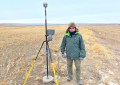
In addition, documenting the locations of underground utilities or features with the BLK3D can help to avoid some serious problems and it reduces unforeseen costs.
Document finished work with a complete visual and dimensional archive of your project.
Visit the Leica Geosystems website to learn more about the BLK3D.
REALITY CAPTURE
Capture 3D measurable images.
LASER
Use the integrated Laser EDM to add highly accurate measurements to 3D images, or to take stand-alone measurements.
SKETCH & DOCUMENT
Create floorplans and attach measurable images to them. Useful for documenting construction progress over time.
NEW PROJECT
Group 3D images and floorplans as a Project
ORGANISER
Organise projects